Vinland Blog 2022
Introduction
I have always been interested in the Vikings, especially their visits to North America and the encounters with the natives (Skraelings). As if to spur this on, I was commissioned to build a model of a Viking Longship for our Local Scandinavian Cultural Center. Near the same time I obtained a copy of the book Westviking by Farley Mowat (1965) and after reading it, we decided to take a vacation to Newfoundland where L' Anse Aux Meadows, the only verified Norse site in North America is located. What I learned in Newfoundland and the subsequent results of my research is remarkable.
Archive 2011-2017
Archive 2018
Archive 2019
Archive 2020
Archive 2021
Back to home page
|
Probability Factor
PF1. Not likely. Prove to me that it is.
|
|
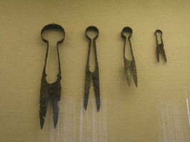
| An array of Viking cutting tools from Denmark:Sheep shears to snips |
|
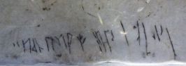
| Viking grafitti in Byzantium at the Haga Sophia Cathedral |
|
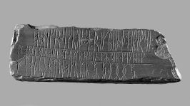
| The Kingittorsuaq Runestone found in 1824 in Northern Greenland |
|
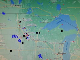
| Map 7:Sites and artifacts of the Graenaveldi combined |
|
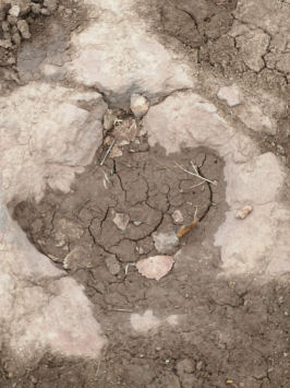
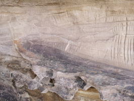
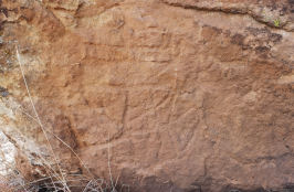
| Oklahoma: Dinosaur footprint in stone |
|
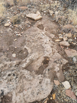
| Oklahoma: Human(?) footprints at same strata |
|
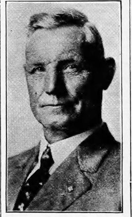
| Otto Allman who discovered the 1920 Mora Battle Axe |
|
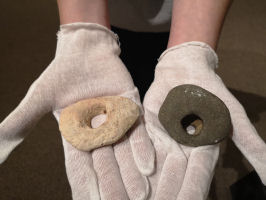
| Found in the Graenaveldi. Spindle whorls, door hinges or natural rock formations? Your guess. |
|
| Ogam Letters |
|
| Examples of Ogam, Anubis Caves, Oklahoma |
|
| Examples of Ogam, Anubis Caves, Oklahoma. Note how the original markings have been graffitied over |
|
| Examples of Ogam, Anubis Caves, Oklahoma |
|
| Examples of Ogam, Black Mesa, Oklahoma |
|
| Hinge Ogam on side of sculpture, Poteau museum, Oklahoma |
|
| Very Weathered Ogam, Black Mesa, Oklahoma |
|
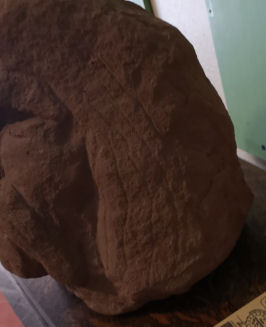
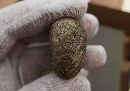
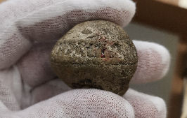
| Whetstone or Metate Grinder?, Kenton, Oklahoma |
|
| The reason the location of the Anubis Caves is kept confidential |
|
| Possible runic inscription - Anubis Caves (Photo-Author) |
|
| Possible runic inscription - Anubis Caves (Photo-Author) |
|
| Possible runic inscription - Anubis Caves (Photo-Author) |
|
| Possible runic inscription - Anubis Caves (Photo-Author) |
|
| Possible runic inscription - Anubis Caves. Some old graffiti obvious nearby.(Photo-Author) |
|
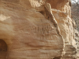
| #AC1 Very old ship petroglyph - Anubis Caves (Photo-Author) |
|
| #AC2 A more distinct ship petroglyph - Anubis Caves (Photo-Author) |
|
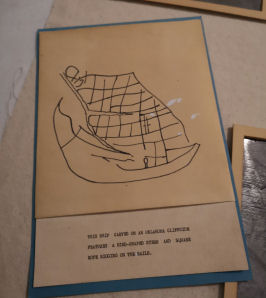
| #BM1 The Ship With the Bird Prow - Farley (Drawing-Shuller) |
|
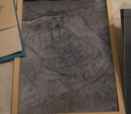
| #BM1 The Ship With the Bird Prow - Farley (Photo-Shuller) |
|
| #BM2 A ship petroglyph at the bottom of a large boulder in the Black Mesa area (Photo-Author) |
|
| #BM3 Not a sail but a hull in the dark markings (Photo-Author) |
|
| #BC1 The Emblem Ship |
|
| #BC1 The Emblem Ship (Photo-Author) |
|
| Black Mesa, Oklahoma (Photo-Author) |
|
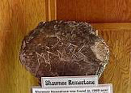
| The Shawnee Runestone at the Poteau Museum (Photo-Author) |
|
| The Shawnee Runestone original display |
|
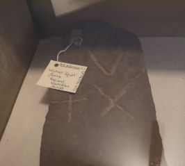
| The Warner Runestone at the Poteau Museum (Photo-Author) |
|
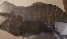
| The Poteau Runestone at the Poteau Museum (Photo-Author) |
|
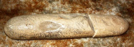
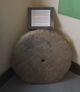
| The Neff Spur Mill Stone at the Poteau Museum (Photo-Author) |
|
| The Morris Creek Runestone (Heavener #2) at the Heavener Runestone Park Gift Shop (Photo-Author) |
|
| Gloria Farley's translation of three Oklahoma runestones |
|
| Site of the Heavener Runestone. The administration building can be seen at the upper left.(Photo-Author) |
|
| Shelter protecting the runestone as seen from the gift shop.(Photo-Author) |
|
| The natural spring at the head of the valley.(Photo-Author) |
|
| The inscription on the stone.(Photo-Author) |
|
| Close up of G, L and O.(Photo-Author) |
|
| Close up of M.(Photo-Author) |
|
| Close up of E.(Photo-Author) |
|
| Close up of D, A and L.(Photo-Author) |
|
| Looking down 'Glomes Valley'towards the Poteau (Photo-Author) |
|
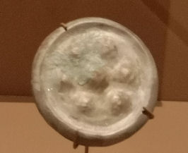
| Copper Earspool replica, Spiro Mounds (Photo-Author) |
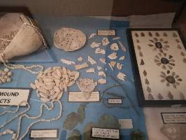
|
| Trade Beads, shells and copper fragments, Poteau Museum (Photo-Author) |
|
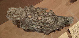
| Highly engraved bone, Poteau Museum (Photo-Author) |
|
| Copper Eagle replica, Spiro Mounds (Photo-Author) |
|
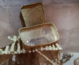
| Copper plates in a woven basket, Spiro Mounds (Photo-Author) |
|
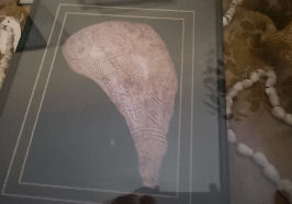
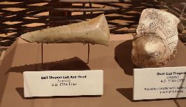
| Axehead and shell cup fragment, Spiro Mounds (Photo-Author) |
|
| The Poteau Mountain Runestone (Heavener #3) outside the Heavener Runestone Park Gift Shop (Photo-Author) |
|
| Map of the mid southwest (Oklahoma) |
|
| The Chief Joseph Tablet |
|
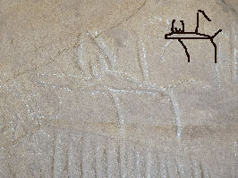
| Jackal Hieroglyphic, Anubis Caves (photo-author) |
|
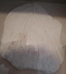
| The Pontonoc tablet plaster cast - Poteau Museum (photo-author) |
|
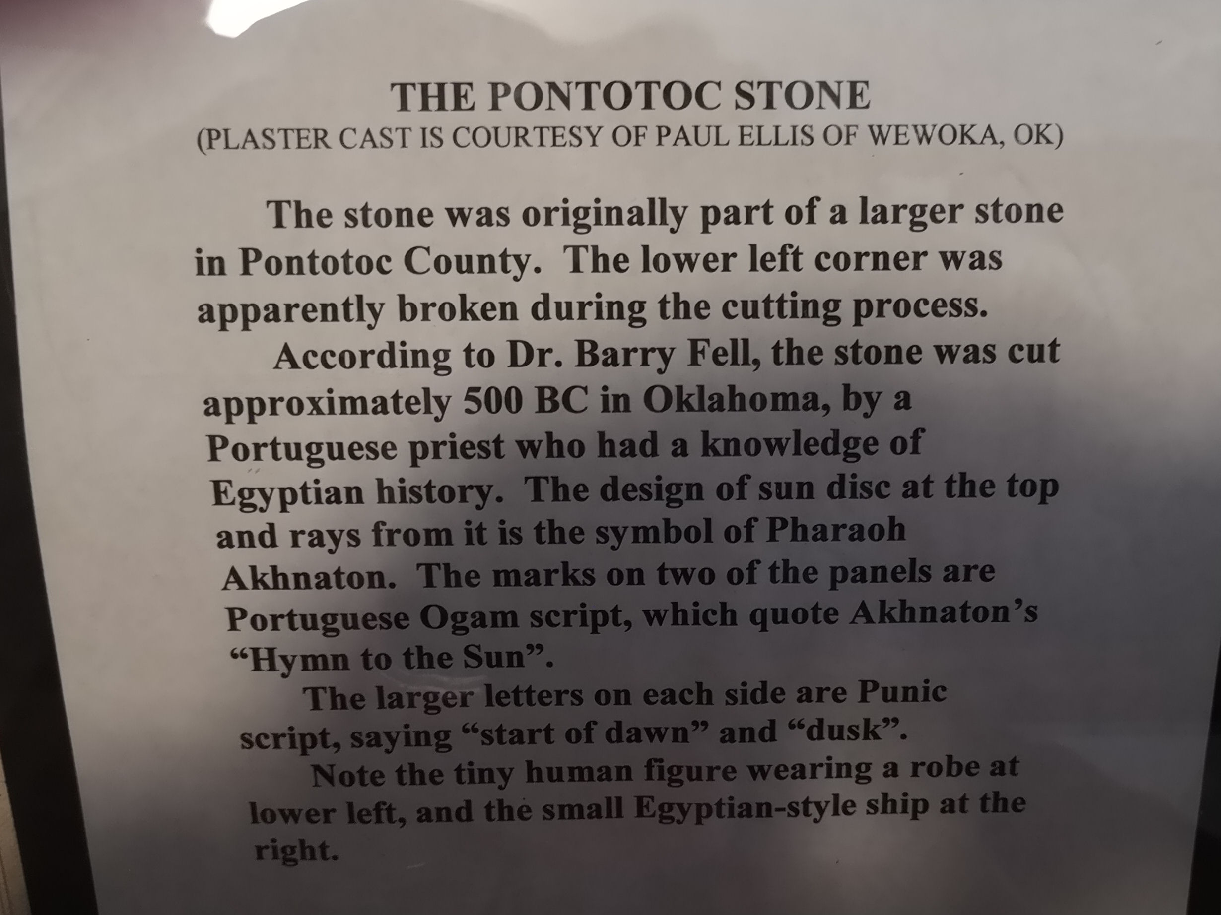
| Poteau Museum write up on the Pontonoc stone (photo-author) |
|
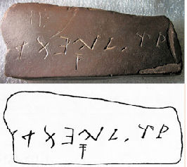
| The Bat Creek stone |
|
| The Carthaginian Goddess Epona (photo-author) |
|
| The Sun God Bel (photo-author) |
|
| Swift Runner (photo-author) |
|
| The Roseau Stone - facing (photo-author) |
|
| The Roseau Stone - side view 1 (photo-author) |
|
| The Roseau Stone - side view 2 (photo-author) |
|
| The Roseau Stone documentation (photo-author) |
|
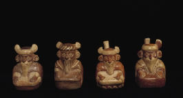
| Moche bearded men, Peru |
|
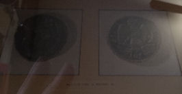
| Photograph of Bronze As of Nero, Poteau Museum (photo-author) |
|
| Celtic bronze axe head found in the Amazon basin (pbs: Carthages Lost Warriors) |
|
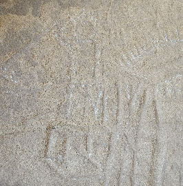
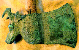
| Celtic bull or buffalo? Anubis caves (photo-author) |
|
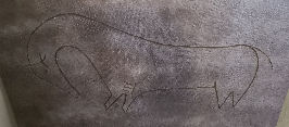
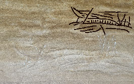
| Not a Viking ship. Anubis caves (photo-author) |
|
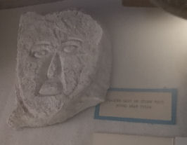
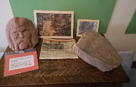
| Plaster cast of Celtic face, Poteau museum (photo-author) |
|
| A small stone bearded face, Poteau museum (photo-author) |
|
| Bust of Haga and tablet found at Bache, OK, Poteau museum (photo-author) |
|
| Close up of Haga, Poteau museum (photo-author) |
|
| Petroglyph of six toes - New Mexico (photo-author) |
|
| Some of the Silverbell Road artifacts (Arizona State Historical Society) |
|
| Elephant and ??? - Anubis Caves (photo-author) |
|
| Fort Mountain works, Chatsworth, Georgia |
|
| Drawing of the Piasa Bird from Henry Lewis� Das Illustrite Mississippihal published in 1858. |
|
| 1920s version of the Piasa Bird |
|
| 1984 metal sign version of the Piasa Bird |
|
| Picture of Mishipizhou at the Royal Ontario Museum (photo-author) |
January 15
I am starting 2022 with some photos from my gallery. Enjoy. Then, we continue with an interesting theory about the Graenaveldi:
The Graenaveldi Althing
Could the Kensington Runestone Hill have been the location of the Graenaveldi Althing? It appears to be somewhat centralized and there is a noticeable lack of hard artifacts turning up in the immediate area nearby. Mooring stones on the surrounding hills could be markers for booths. Mooring stones in low lying areas also could be booth markers or boat moorings.
The KRS could very likely be a memorial. Are there other runestones buried on this hill? Other mooring stones? Perhaps.
A serious Lidar investigation of Runestone hill is in order but looked at in the correct context (such as we discussed about Point Rosee in a previous blog). Not only should we be searching the hill itself but especially the areas around the mooring stones looking for telltale signs of temporary booths.
Why did they come this far west?
This is one of the first questions I pondered and took quite a while to not find a feasible answer. There is the strategic location that we have mentioned previously of course but there are other circumstances to be considered.
The Norse had a nasty tendency to get into disagreements as is backed up by numerous sagas. Perhaps these people in the Graenaveldi were outlawed. Maybe a blood feud required this group to flee. Religion might have been a factor. There is little evidence whether this group of Norse were Pagan or Christian. Maybe they were just plain wanderers that found a nice place to settle. There is also one more factor we have to consider.
Exports
Patricia Sutherland reports 30 whetstones collected from northern Dorset sites by Canadian museums.
Good quality whetstones were of vital importance when dealing with metal tools. They were a valuable commodity probably comparable pricewise to a power tool of today. The secret? A metal core that magnetized iron filings and made tools and weapons sharper.
The Tanfield Valley quantity of whetstones alone is indicative of a trade center commodity. The Dorset did not use whetstones. This is something only used on metal tools. That whetstones could travel this far is backed up by the related find of Dorset burins and a coin in New England which we will examine later.
We have a hint for a source, the Whetstone River area of South Dakota. Also, the plentitude of mooring stones in this area indicate some form of Norse land taking, whether it be a few isolated traders or a more sophisticated colonization attempt.
Furs were certainly traded as well.
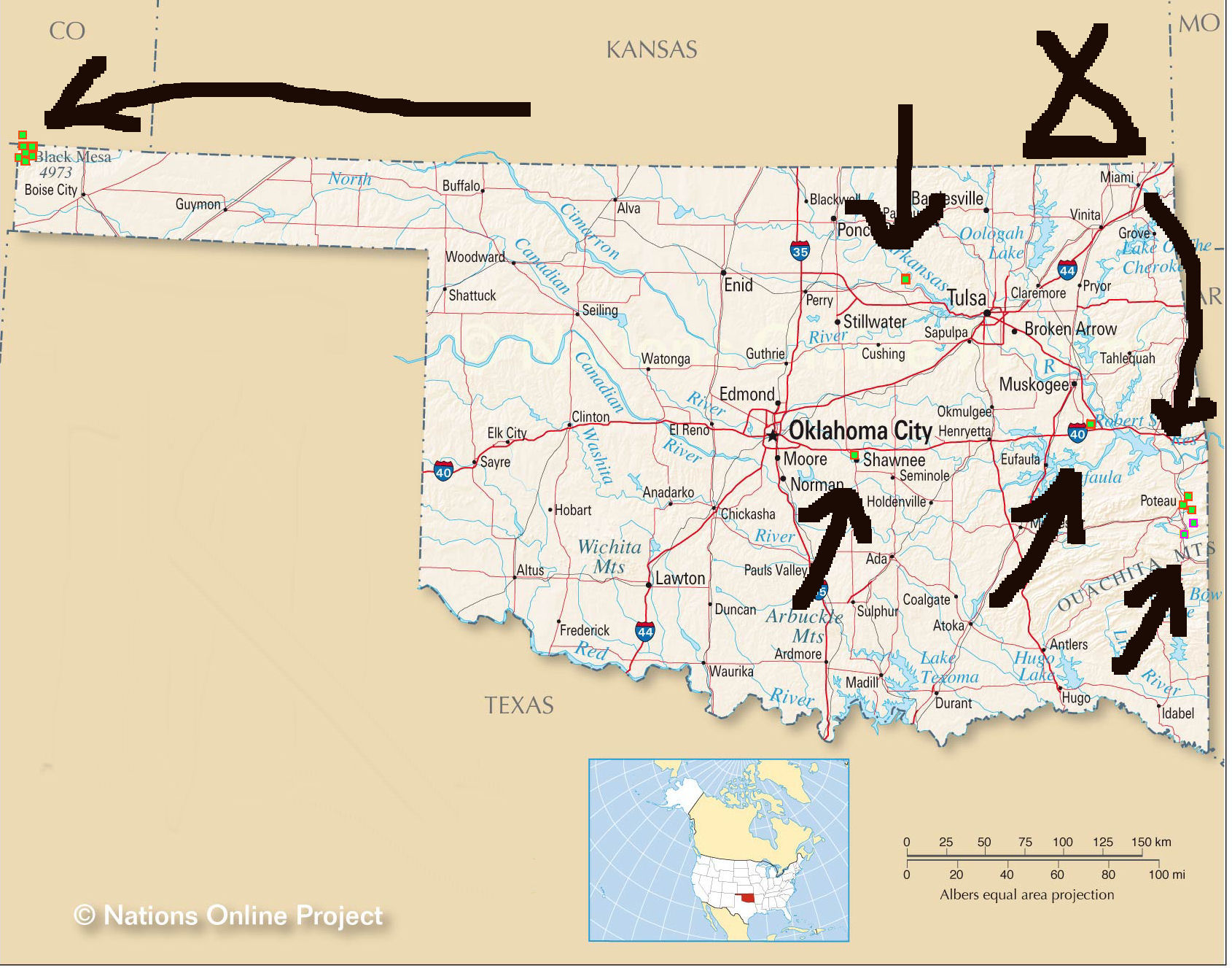
All in all it wouldn't have been any single one of these reasons that brought the Norse this far west but a combination of them. (Map 7)
What happened to them?
Jacob Cnoyen in his report to Mercator states 'four thousand entered the indrawing sea and never returned.' Does he mean North America as a whole or is he referring to the indrawing sea as Hudson Bay and a connection to the population of the Graenaveldi? I would not be surprised that it was our subject territory that could boast that honor.
If indeed there was the potential of a settlement here, I am sure the King's tax collectors would have been in for a big disappointment.
My guess is that the Norse came to this area around 1050 (+-). Land taking shortly thereafter. There are two possibilities here. Either they formed a settlement or as was typical of the Norse in every other area they have been to, they assimilated into the local population. Possibly it was a combination of both.
A population of 4000 spread throughout the Graenaveldi can be compared to a local native population of 50,000 at Cahokia. Closer to the Graenaveldi was the center of Aztalan, a miniature version of Cahokia that housed 500 in addition to whatever peoples were in the outlying areas.
Assimilation seems to be very likely in this case. We have examined the Mandan who show some very European characteristics and came from the area of the western Graenaveldi. Of especial interest is the Viking fortress style villages they made. Also, to the Mandan, their wealth was food. What more do you need in a land that you live on? One was considered in high esteem if one hosted feasts. Oh wait, isn't that what the Norse did as well?
It is most likely the blending of populations took place within four generations. Peter Kalm, our Swedish botanist from the 1700s who personally spoke to Pierre De La Verendreye, makes an interesting comment about the European residents of the new world:
"The Swedes themselves are accused, that they were already half Indians, when the English arrived in the year 1682. And we still see that the French, English, German, Dutch and other Europeans, who have lived for several years together in distant provinces, near and among the indians, grow so like them, in their behavior and thoughts, that they can only be distinguished by the difference of their color."
The full journal can be read here:
This site also has several other interesting reads:
It is also possible that the Black Death reached North America. This would certainly help to explain the rapid decline of Cahokia and the Mississippian Culture around 1350. We can see over the last few years how drastically our own world has changed with the Pandemic and we have many examples of smallpox epidemics decimating post Columbian native populations.
I am by no means an expert so this is where I stop and the professionals will need to do their part. Future technology and the enthusiasm of modern thinking archaeologists will help answer the mystery of the Graenaveldi.
Vinland Vignette
Did the Norse find a Northwest Passage?
When I first started this journey of exploration into Viking visitations to PCE North America I was, like many others, of the opinion that they settled at L'Anse Aux Meadows, did some minor exploration of other parts of Newfoundland, made an attempt at colonization and departed, never to return. I actually considered it groundbreaking that there was more than one Viking site on 'the rock'. This is what the Vinland sagas told us. There was nothing else. That the Norse were anywhere other than the east coast was incredulous.
However, as I continued to dig deeper into my research I found that there was a lot more to the Vikings in North America than I anticipated. I gradually accepted the fact that they explored a good portion of North America.
Reports that they were in South America (Brazil, Bolivia, Paraguay, Peru) on both east and west coasts is incentive to wonder how they got there.
The east is quite straightforward. They would have originally went down the east coast of North America into the Gulf of Mexico and later down the Mississippi River.
The west coast is different. To reach it via the Gulf of Mexico would require travelling overland through the lands of the Mayans, Toltecs and Aztecs. (Strangely there is a gap in the cultures of the MesoAmerican timeline between AD 900 and AD 1100.) Coming from the west means circumnavigation of the globe, from the south would require rounding Cape Horn and from the north a Northwest Passage.
We have evidence of the Norse in Hudson Bay and down the Red River. They used the Nelson River system to get in Lake Winnipeg and points south but we also have indication they were in the Churchill River system.
Following that system we get to South Indian Lake, Leaf Rapids (see our entry on 'white man writing on rock'), Granville Lake, Puktawagan (going south gets to the Saskatchewan River system and the Adzes at Prince Albert) and Reindeer Lake.
With the existing maps and waterways as they are a portage would be needed between Reindeer Lake and Wollaston Lake but this would be less than five kilometers (three miles). In the past, with higher water levels there may have been a through passage here.
From Wollaston Lake to Lake Athabasca, Slave River, Great Slave Lake and the Mackenzie River to the Beaufort Sea is easy sailing. Around Alaska and a traveller arrives at the west coast of North America.
Although feasible I don't think this would have ever become a major route. It would have been far easier to occupy MesoAmerica. Perhaps the Toltecs were conquered by the Vikings who, after two hundred years of cohabitation with the migrating Adena became the Aztecs.
Dating the Knudsen Expedition
How can we so precisely date this expedition to 1361-1364?
First we have the comment of Philippe De Mezieres in 1369 that 'the Kingdom of Norway was so vast with lands so far that it took tax collectors three years to go there and get back'.
If we look at directions from Bergen, there is not much territory to the east where crusades against the Pagans are taking place at this time. South of here is the Holy Roman Empire, what is left of Byzantium and the colonies of the Rus who by now are a separate culture. The north is inhabited by Jotuns so that leaves only the west.
It then makes sense that tax collectors went to the middle of North America. The KRS is dated 1362 and certainly backs this up as does the mention by Cnoyen of eight returning in 1364. The expedition must have started in 1361 and took a year to get to the Graenaveldi via New Vinland. Proceeding north to Hudson Bay, they would have met up with Nicholas of Lynn who was already there charting the north. Overwintering at the 'haven', they returned in 1364.
Again I reiterate that it may not neccesarily have been Paul Knudsen that was the leader of this expedition. Knudsen is not heard of again after his letter of marque dated 1354. It is possible he succumbed to the Bubonic Plague and although this is the only document known at this time, there could have been several other letters of marque issued.
February 15
World Trade Is Not New
The real extent of the trade network that the Norse participated in can only now be comprehended. We can go back to the Old World and have a peek at a few things that have come from PCE (Pre Columbian Era) North America during the Viking and Norse age.
Items known to be regularly exported from Greenland were walrus ivory, live polar bears, polar bear fur, arctic fox fur, arctic hare wool, whale oil and unicorn horns (narwhal tusks). Maple is known from the Vinland Sagas. Helge Ingstad in his research identified distinctly North American stone arrowheads, martens and anthracite coal while Hjalmar Holand reports fur from elk, black bear, beaver, otter, ermine, sable, lynx, glutton and wolf. (I don't know what glutton is either). In 2000 the Smithsonian reports of North American brown bear hair and bison hair weavings via Greenland. (I would be intrigued to learn if these were wood or plains bison.) Chests made of American wood found in medieval PCE Europe are logged by Irwin in 1980.
Historically we have Bills of lading dated 1380-1420 in London from Basque ships. They contain bundles of beaver pelts. (Russian beaver pelts were always shipped in barrels). In England, Stokes Dry Church a medieval (PCE) church constructed about 1250 had renovations done in the late nineteenth century. A wall torn down revealed a mural of Indians in feathered headresses shooting arrows into a bound figure. A picture very similar to that of the death of King Edmund, who was executed by the Vikings in 869.Roslyn chapel Scotland built in 1446 shows carvings of aloe and maize. A grave marker there from 1439 also shows corn and cactus in the Sinclair family crest while a painting of a turkey is in a cathedral built in 1280. (Turkeys were not introduced to Europe until 1530.)
We have hitchhikers. New England clams have been found in 1200-1300 sand strata in Klagen, Jutland while European periwinkles have been found in the medieval sand strata of Halifax harbor.
We can go even further both in area and time period for it is impossible to examine the true extent of the Norse interactions in North America without encountering other old world cultures.The Cochineal dye of Ancient Judaea is from an aphid that grows only on cactus from North American deserts. Peanut shells have turned up in Chinese archaeological digs dating 2000 BC. Corn has been found in 4 ancient temples in India while cocaine and nicotine have been found in Egyptian mummies.
Back in North America we have Incan coprolites and mummies that show traces of Southeast Asian parasites and in Ohio, burial mounds turn up cowry shells from Malaysia.
None of these items can be considered as inconceivable as they once were. We know the extent of the Norse involvement in the European and Asian trade networks and they obviously weren't the only ones. Silk from China was found in the Oseberg ship in 1893. A bronze Buddha from India was found in a Swedish farmhouse on an island just off Jutland. The same farmhouse revealed Coptic Christian (Ethiopia) votive pots. Trading of slaves was a common Viking practice, the more exotic the better.
******
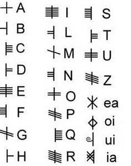
Ogam or Ogham
As we enter the south midwest we encounter a new footprint, that of Ogam. This is a Celtic writing which essentially uses marks above and below a stem line to form letters.
Originating with the Hiberno-Celts of the pre-Christian era, Ogam travelled with the Celts through Gaul and Britain, eventually ending up in Ireland where it was the preferred form of writing with the early Christian monks of the fifth century and onwards.
There are two major variations of Ogam. Vowelled and vowel-less. It is generally believed the 6th century Ogam had vowels while the older Celto-Hibernic Ogam is vowel-less.
I have brought up Ogam as I believe the descendants of 6th century Celtic monks and their peoples had some form of relationship with the Norse. I have listed what I feel were the earlier Iberic Celts in their own section while the Alban Celts are incorporated later into Central and East.
We can thank Dr Barry Fell (1917-1994) for much of the earlier groundwork deciphering the many ancient writings that are all over North America. His work on translations, although some has now been corrected, was epic in bringing the true history of PCE North America to light. He readily admitted to his own fallibility, stating: "I am not always 100% correct, this is the way I see it now. I learn as I go along, and if I find that I am wrong, I will say so."
Fell founded the Epigraphic Association in 1974.
Another pioneer instrumental in the area we are about to look at was Gloria Farley (1916-2006). She was a housewife who became maniacally passionate about the many ancient inscriptions in her area (Oklahoma). It was said she would climb anywhere to study one. Her book In Plain Sight details much of her research.
More runestones and inscriptions are steadily turning up in the south midwest and I am pleased to hear of others that are taking up the torch in this research. I will leave them to it as I must eventually get back to Vinland with this blog. Anyone who thinks they may have identified a runestone in the south midwest is invited to contact Gary Courtney, author, photographer and historian, at 918-822-0299, or by email at blackhawkpublishing@hotmail.com.
Here are a couple good links:
runestone-may-have-viking-roots
An Archaeologist Looks at the Oklahoma Runestones
The above is an excellent open minded article with only a few inaccuracies. The author, (Lyle L. Tompsen) looks at some (not all) of the items we will cover. He does not mention any other culture's runestones in the area but takes a good look at Scandinavian migration, counterfeiters and spurious/genuine stone carving methods.
A book to read is:Ancient American Inscriptions by McGlone, Leonard, Guthrie, Gillespie, Whittle.
Another source for anyone wanting to delve further into Ogam is the Midwest Epigraphic Society facebook page.
******
Vinland Vignette
History Buff Horror Story
As we continue our search for the Vikings in the South Midwest, we run across a story that will horrify enthusiasts of the past and show what modern researchers are up against. This experience happened to Gloria Farley, one of the pioneers of epigraphy in that area.
We let Gloria tell it in her own words from her book In Plain Sight:
Although descriptions of approximately seventy carved stones were obtained, my efforts were about twenty years too late. Of course some of the described seventy had to be natural marks and some may never have existed. But the statements I gathered contained so much sincerity, that there surely once had been dozens of runestones.
Treasure hunters had thought the writing was made either by early Spanish explorers who had brought in "Twenty jack-loads of gold," or indicated treasure from robberies stashed away by Jesse James. The destruction of dozens of these inscriptions is explained by one testimony. In the 1960s a local man came to me to say:
"Mrs. Farley, I'm sorry, I didn't know what it was. There was a yard square stone lying flat on the plateau above Kitchen Canyon. It had several rows of four inch letters on it like the big runestone. I'm sorry but I broke it up with a sledge hammer."
"Why?" I managed to ask.
"So the other fellers wouldn't know where the treasure was."
"Did you find any?"
"No."
"Let's you and I go there and put the pieces together."
"I threw them over the cliff."
"Well did you copy the letters before you beat the stone to pieces?"
"COPY them?"
March 15
SOUTH MIDWEST
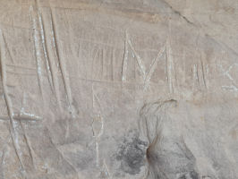
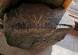
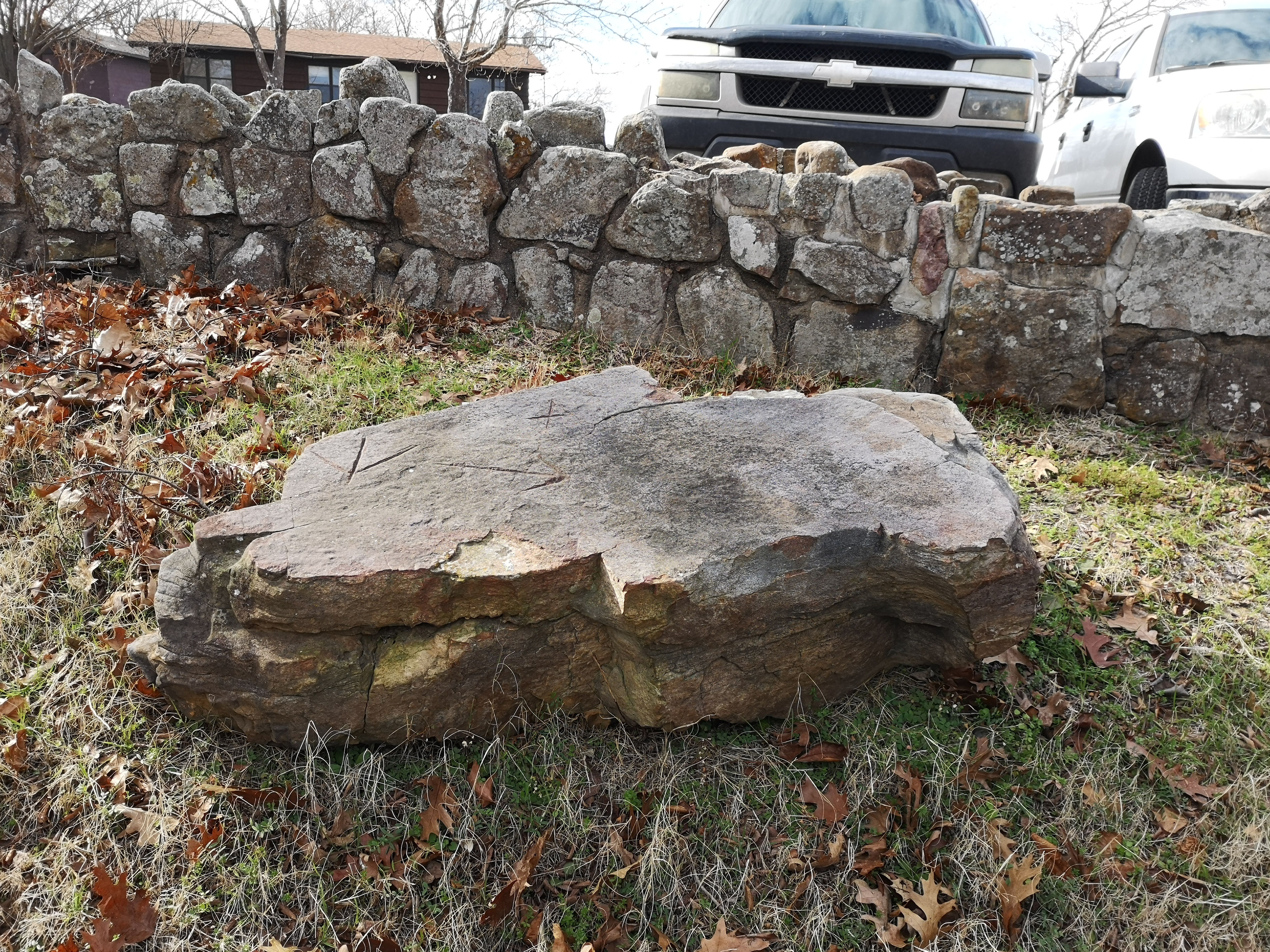
My prime interest in Viking presence in the south-midwest of America was fueled originally by the Heavener Runestone (hee-vener), which will be examined in detail later. Then, while doing some research, a photograph of an unusual stone broken in two pieces that was found in a field in Kenton, Oklahoma, caught my attention. I was well aware of the nearby Anubis Caves (named after its Egyptian jackal heiroglyph) that contained numerous ancient markings but I did not really consider the Norse to have ventured this far. Maps, however, show that the Cimmaron River connects through the Arkansas River to the Mississippi and ends near the Anubis Caves to become the dry Cimmaron and Chorizo (yes like the sausage) creek. Nearby is the North Canadian River which also links into the Arkansas. Westward from there, ancient overland trade routes make contact with the Colorado River and other water systems flowing into the Pacific as well as the Rio Grande which flows into the Gulf of Mexico.
So I followed the Norse who followed the trade routes. Let's see where they went.
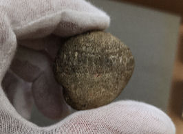
Kenton, Oklahoma
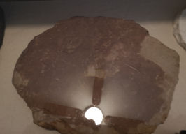
Whetstone
The photographed stone was plowed up in a field near Kenton. When inquiring about it the curator of the Kenton Museum showed me several that he stated were metate (corn) grinders. They were indeed larger and heavier than Norse whetstones, designed for use with two hands. We never did locate the original stone from the photograph. I shelved my dissapointment. Not every lead is successful and not every picture is what you think it is.
Later at home,having another look at the original photo, I noticed the numerous metal cut marks on the top of the broken stone. Additionally, there was no size indicated. This one certainly bears another look at.
Geographical location: 36.899,-102.966
PF 2
******
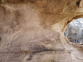
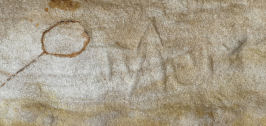
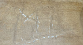
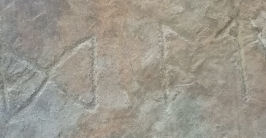
Anubis Caves
Kenton, Oklahoma
Ogam
Runes
Ship Petroglyphs
These limestone caves seem to have been a gathering area for quite some time as numerous old world cultures have left their marks here. The location given here is that of the Kenton Museum as many new world cultures have left their marks here as well. The actual site of the caves is on private land and kept confidential to prevent further vandalism.
Ogam
There are several Ogam inscriptions in the caves as illustrated previously. They all appear to be Hiberno-Celt and are mentioned here as a point of interest only.
Runic Inscriptions
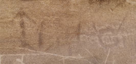
There are possible Elder Futhark runic inscriptions in caves 3 and 4. Unfortunately, due to erosion, overwriting and simply time they are extremely difficult to decipher. There is also a likelihood they might belong to other peoples as well but these runes are clearly visible: Algiz, Ehwaz, Gebo, Ingwaz, Isa, Laguz, Manaz, Othila, Teiwaz and Uruz. There is a special use of Naudiz reversed which may be a Younger Futhark A (the letter 'Ar') but could also be considered as a Merkstave. A Younger Futhark H (Hagal) and a Teiwaz on its side or a pointer are also present.
All of these inscriptions seem to be very basic and appear to be like many others that are here, if anything, that of a wayfarer leaving his mark.
PF 2
To travel waterways you need ships and they abound in the carvings of the local peoples. Obviously these would be impressive enough to be included as part of their Art, especially a massive square, billowing sail. There are numerous ship examples in this area but I am limiting the entries here to those that show possible Norse characteristics.
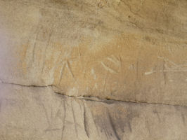
Ship Petroglyph #AC1
In an obscure corner of the caves there appears to be an image of a square rigged ship sailing low in the water. The incised lines of the petroglyph are quite dark indicating some age. At the top a main spar can be seen with square rigged sail beneath. The mast connects to the hull at the bottom of the petroglyph.
PF 2
Ship Petroglyph #AC2
Another square rigged sailing ship can be seen in a different part of the caves. A high prow is clear at the left and not so clear at the right. Flaking from the elements can be seen and it is worth noting that this flaking occurred some time AFTER carving.
PF 2-3
Here is what Gloria Farley has to say about the Anubis Caves:
Geographical location: 36.899,-102.966
******
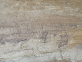
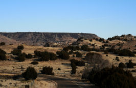
Black Mesa Area/Oklahoma Panhandle
Ship Petroglyphs
Ship Petroglyph #BM1
This carving is part of a 40'long panel on a 25' high cliff. The panel was originally recorded in 1950 by the Weisendanger Studies but not identified as a ship, being only partially chalked in their original photographs, taken on ladders. Gloria Farley in 1973 identified this petroglyph as a ship. Photographs with a telephoto lens were taken in 1978. In her book Farley identifies this as 'The Ship With the Bird Prow' and makes a convincing argument it could be an East African or Roman trade ship.
From the rather indistinct photograph however, the prow decoration could possibly be a serpent and the markings along the side a line of shields. We all agree on a square rigged sail in perspective.
Too bad Gloria never had a drone, but we do. Any takers?
PF 3
Ship Petroglyph #BM2
Again, extreme age of the petroglyph is suggested by its dark lines. We see a square rigged sail with what could be a prow decoration to the right.
PF 2-3
Ship petroglyph #BM3
In dark lines are what appears to be the hull of a ship with plank lines. prow and stern may have decorations. Other fresher carvings can be seen in much lighter marks over top.
PF 2-3
Geographical location: 36.851, -102.878
******
Baca County, Colorado
Ship Petroglyph #BC1
On the lower left corner of a large boulder filled with many petroglyphs is the image of a ship first recorded in 1978 by Dale Murphy.
Gloria Farley named this carving 'The Emblem Ship' and it is actually a slightly modified drawing by Dr. Barry Fell that is the emblem of the Epigraphic Society.
They (Farley-Fell) interpret this petroglyph as being Portugese first century AD (Celto-Iberic) but again I would raise the possibility of Norse with billowing square rig sail, prow and stern decorations.
PF 3
Geographical location: 37.394, -102.529
******
Vinland Vignette
Edgar Cayce on the Vikings
Edgar Cayce was a well known medium from the early twentieth century who would go into a trance and give 'readings'or 'channelings'. Although most of these readings were to do with people's personal health, he also made many interesting predictions and spoke about other matters in his channeling. Here is what he had to say about the Vikings:
******
The Jinx of Mentioning the word 'Shutout'
Have you ever wondered about why we won't say 'shutout' when a goalie in a hockey game is near to getting one?
This is word for word from a Smithsonian Publication dated 1951 called 'Two Runic Stones, From Greenland and Minnesota' by William Thalbitzer. He is discussing the use of magic in Viking runes:
"The Norsemen had the same custom as the Eskimos, namely, not to mention by its true name the object to which one applies the magic, or the animal one wants to catch at sea�a kind of name taboo. When hunting at sea the Eskimos use substitute or circumlocutory words to denote the game in order not to scare it away by betraying their own intentions."
******
Historia Norwegiae
Here are a couple excerpts from that respected publication:
But in 1346 the Knorr had returned with riches from the southernmost settlement of Greenland, the Eastern Settlement, an extremely fortunate event, as the realm was in need of money. It was further known that the Skraelings had attacked the Norsemen from the north, as may be read in the Icelandic annals: "They are now in possession of the Western Settlement."
and
Likewise all this, as said before, was told us by Iffver Bardsen Greenlander,who was principal in the bishop's residence in Gardar in Greenland for many years, that he had seen all this, and that he was one of those who was appointed by the law-speaker to go to the Western Settlement against the Skraellings to drive them out of the Western Settlement, and when they arrived there, they found no man, neither Christian nor heathen, nothing but some wild cattle and sheep, and they fed on the wild cattle, and took as much as the ships could carry and then returned home and the mentioned Iffver was with them.
******
Here are some interesting Viking articles. Thanks Tom:
Why the Vikings abandoned Greenland
Vikings Weren't all Scandinavian
Slava
Ukrainia
April 15
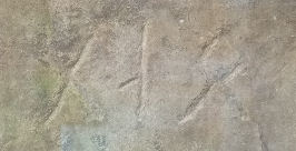
Shawnee, Oklahoma
Runestone 1969
'The Shawnee Stone' was discovered in 1969 by James Estep, Mikel Lindsey and David Sersen. This 14" stone was found face down in a tributary of the North Canadian River. It displays the elder futhark inscription MEDOK.
The sandstone rock shows little signs of wear and this has been a cause of discourse since its discovery. It is possible the second character could be an incomplete A and refers to the Welsh Prince Madoc, simply being a poor translation.
The biggest anomaly with this theory is the date range. Elder Futhark was used between AD 300 and AD 800 while Madoc was said to be in North America circa 1150 AD. Also, the lack of completion may indicate someone with a shortage of knowledge of true elder Futhark.
This stone is on display at the Poteau museum.
Geographical location: 35.362,-97.101
PF 1-2
******
Pawnee Oklahoma
Runestone
I could find very little information but anything I find likens it to the Shawnee stone or the Poteau stone.
Geographical location: 36.338,-96.817
PF 2
******
Warner, Oklahoma
Runestone 2014
Brent Gorman found this stone that consists of three runes, a diamond, a plus and an x. It was buried in a field one quarter mile from Dirty Creek, a tributary of the Arkansas river. It is noted that the exposed portion of the stone shows significant aging as opposed to the buried portion.
Fell identified it as Numidian from 400 BC claiming it to be a boundary marker but it is possible these could be Elder Futhark runes.
This stone is on display at the Poteau museum.
Geographical location: 35.492,-95.327
PF 3
May 15
Poteau, Oklahoma
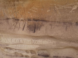
Runestone 1967
The Poteau Stone was discovered in 1967 by schoolboys Mike Griffeth and Henry McBride. This 15"x2" shingle was pried from a rock ledge on Terry Hill near the outskirts of Poteau.
Geologist Paul Richardson examined the stone and stated it was Pennsylvanian age Savanna Formation with a hardness of 7 on the Mohs Scale.
Gloria Farley visited the original rock shelf the tablet was pried from. She made specific note that the ledge was heavily encrusted in a regional flat gray lichen. She related that the boys carefully cleaned the runestone with a scrub brush but that a tiny piece of original lichen remained on the side of the stone. Farley also commented that the runes were carved in the same style as the Heavener stone (next month's listing).
The crudely scratched runes are Elder Futhark and translate as GLOIEALU.
Runologist Richard Nielsen states that Gloie is a nickname for Glome, the name on the Heavener Runestone. Alu translates as 'magic to' or 'protection to'. It is suggested this inscription may be a memorial to Glome.
It is interesting to note that whoever carved this stone had some knowledge of Elder Futhark and the language of the time.
This stone is on display at the Poteau museum.
Geographical location: 35.054,-94.629
PF 2-3
******
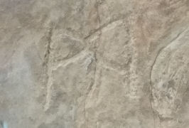
Neff Spur, Oklahoma
Mill Stone
This well used mill stone has two Elder Futhark runes inscribed on it, Hagalaz and Othila. It was typical for the Norse to inscribe magical runes on their tools and implements.
As a point of interest, demographic studies have shown a good number of Scandinavian immigrants to Oklahoma in the late 1800s after the Indian Territory was opened up.
This stone is on display at the Poteau museum.
Geographical location: 35.072, -94.591
PF 3
******
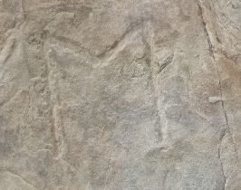
Morris Creek, Oklahoma
Runestone 1954
This stone, also known as the Heavener Stone #2 was found by Ed Baker in a canyon east of Heavener. It features an Elder Futhark Algiz at the top and a very small Teiwaz or pointer on the side.
This stone is on view at the Heavener Runestone Park Gift Shop.
Geographical location: 34.923,-94.580
PF 2-3
June 15
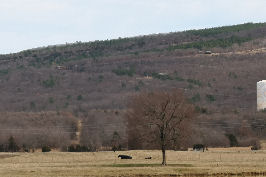
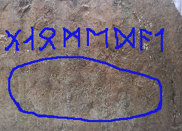
Heavener, Oklahoma
Runestone 1832
Almost due south of the Kensington Runestone (45.810, -95.661) with less than a degree of longitude difference is the Heavener Runestone. In a valley just east of Heavener, Oklahoma, this large stone exhibits some simple Elder Futhark Norse runes which state something along the line of GNOMEDAT or GLOMEDAL. It was first reported by a Choctaw hunting party in 1832. This is based on an oral family tradition of Henry Horntubby and his son Israel. We know it has been documented and viewed regularly since the 1870s. Local legend named it 'Indian Rock'.
The stone is 12' x 10' x 16" thick. The runes run left to right from 6 1/2" to 9 1/2". It stands directly on a north-south axis based on the north star. It was originally seated on a stone slab but this was destroyed in the 1930s by treasure seekers.
Since then a park has been established and the stone housed in a shelter.
I considered the possibility that this could be a Gnomen, a Norse geographical marker stone. Perhaps that is what the lettering was about. That it is directly aligned north-south has to be taken into consideration. This stone is on the latitude of 34.895. Here are some comparable latitudes:
Malta 35.942
Tangiers, Straits of Gibraltar 35.763
Knossos, Crete 35.297
Mount Olympos, Cyprus 34.911
Homs, Syria 34.730
Tripoli=34.427
Nazareth=32.173
Jerusalem=31.796
As of 1928 the Smithsonian was of the opinion that "the runes followed Scandinavian grammar of the 9th century."
The stone shows weathering and lichen growth. Gloria Farley, who was instrumental in the recognition and preservation of this artifact, wrote the date February 2, 1951 in pencil on the stone. The mark was still clearly visible after 7 years. (I missed checking for this when I visited.)
Geologist Scott Wolter took a sample of the quartzite for a weathering profile. Taking a sample from the runes to compare could then determine the age of them. However, that would require damaging the runes. This is a case that must wait for future technology. Sorry Scott.
There are some viewpoints that this could be a memorial or marker left by La Salle in the early seventeenth century.
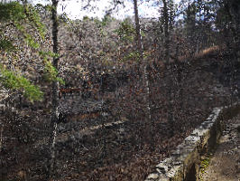
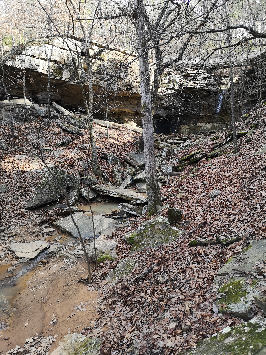
According to Neilsen and others GLOMEDAL translates to 'Glome's Valley' and when entering this area one can immediately see why Glome would want to claim this piece of land. Fresh water is the most important natural resource of all. It was, is and always will be.
As one descends from the gift shop to the base of the valley where the stone is located, first is heard and then is seen a flow of pure water that comes from a rock spring. It turns into a creek that commands a gentle downhill valley. On a map it can be seen that this spring is part of a much larger watershed that eventually empties into the Arkansas River.
Incidentally, this watershed pattern can also be seen in the suggested areas of Iowa that we have glimpsed at. It is noticeable in the Whetstone River area of South Dakota as well as in north-central Minnesota.
Is it possible this stone could be both a territorial AND a geographical marker?
Here is an interesting article that discusses other thoughts on this runestone:
Geographical location: 34.900,-94.578
PF 4
******
Vinland Vignette
Thalbitzer, William/Smithsonian - Two Runic Stones, From Greenland and Minnesota
This is an excellent publication that gives a detailed analysis of the runes on the KRS as they were known in 1951. The author does an independent examination and use of logic to associate pendatic dating! He even goes into excellent detail on the evolution of runes to latin.
As a note, Arlington Mallery, around the same time period, came to his own conclusions on Pendatic Dating which were remarkably similar.
******
A Ringerike-style Stone circa 1050 commemorates an individual blown off course from Vinland and perishing in the far north. More indications of post saga colonization.
******
Head Butting
You might call this my ten year rant.
Since I began this blog in 2011, a mere 11 years ago, I am truly amazed at the progress that has been made in discovering the true history of our world.
With advancements in technology some incredible discoveries have been made. Researchers have found the oldest battlesite ever at Tollense Valley, Germany where two sides fought using stone and copper weapons.
We thought the discovery of Gobekli Tepi at 7000 BCE was earth shattering but since then several other advanced civilization sites have been announced that are even older. Karahan Tepi at 9000 BCE is but one of a chain of similar sites in Turkey/Mesopotamia that indicate a form of organized communities. To me this society looks like something that came out of the original Conan the Barbarian movies that made Arnold Schwartznegger famous.
Claims that Egyptian stonecutting techniques (predating the first dynasty) are impossible to reproduce today have been disproved by experimental archaeologists who showed these massive blocks could indeed be cut precisely by copper saws using fine grit sand. However, we have yet to explain ancient drill marks that show resets like they were done by a power tool, granite stone bowls perfectly shaped, the precise engineering of the angles inside the sarcophagus of the great pyramid (that we cannot even replicate today) or a granite statue perfectly carved with a completely out of place, crudely scraped first dynasty cartouche on it.
There is also numerous examples of 'melted' stonework, blocks placed together so perfectly a sheet of paper cannot be slipped between them. Incidentally this has parallels in Mesoamerica and Southeast Asia. (There is other stonework in existence that is also called melted but this refers to ancient cuttings subject to extreme heat like a nuclear blast).
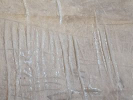
The discovery of Doggerland was made by sonar. A huge sunken society in the North Sea between Britain and Denmark that predates the ice age while recently discovered footprints in stone date back human habitation of North America to 30,000 BCE. They have already been supplemented by cuts on mammoth bones. (I previously posted pictures of footprints in stone from my Oklahoma trip.) Even climate change is adding to our education. Melting ice is exposing more antiquities regularly and there is interesting talk about what is underneath the ice in Antarctica.
Subsequently, the outlandish theories I explored a decade ago are extremely feasible in today's world. The Norse did indeed travel extensively throughout North America.
So With this new day and age we must realign our thinking in the same way. The traditional rift between credited archaeologists and modern thinkers is changing. It is becoming much better but it must depart altogether. One party digs in their heels and insists on relying on books that were written decades ago while the other insists traditional archaeologists are enmeshed in a great conspiracy theory to hide the true history of the world. Some cases even become extreme. Modern scholars are looked at as amateur bumblers with fantastical theories who contaminate true information while traditional archaeologists are considered to underestimate the find and overestimate the finder. Sides become enmeshed in pointing fingers and forget that they both seek a mutual goal, the truth. Neither wins.
Just because an artifact is not found in a controlled archaeological dig doesn't mean it is non existent. Although we do not have precise scientific details about the discovery we can heed the cultural footprints and use them as a lead to what needs to be dealt with analytically. Once located properly worked sites provide us with the accurate data needed to give the scholars the unobjective facts. Using this information we rethink the existing logic theories so that we can advance to the next level in the correct telling of our history.
I will admit that at the beginning of this journey of research I was just as hard headed as the extremists of both camps. However, with age and experience comes temperance. With temperance comes knowledge or as my friend Bobby would say, "The more I learn the more I realize how little I really do know."
With the full cooperation of amateur researchers/experimental archaeologists such as myself, regular accredited professional archaeologists and scientists of all disciplines equipped with modern technology, the correct history of this world we live in will be discovered.
July 15
Spiro, Oklahoma
Spiro Mounds
Almost on the same longitude as the Heavener Runestone and north of it are the Spiro Mounds. This native city was one of the major trade centers of the Mississippian Culture who flourished from AD 800 to 1300. It is inevitable that if the Norse or Vikings were in this area, they would have encountered these native peoples.
Archaeological digs of the mounds (which have been likened to Scandinavian mounds) have turned up numerous artifacts that verify Spiro's status as a trade center (Vik). Large amounts of shell beads and inscribed utensils are from the west coast while hammered copper in various shapes and forms comes from Lake Superior in the north.
Unfortunately the main mound was looted by locals in the 1930s and most of the artifacts sold to private collectors (Joseph 1994). We will never know what was there but it is suggested such treasures as copper breast plates, copper shields, outstanding statuary and large amounts of engraved shell items were purloined.
Geographical location: 35.311,-94.568
******
Poteau Mountain, Oklahoma
Runestone 1959
Documented in 1959 by Wes Thomas, this stone was originally spotted 45 years earlier by him in 1914.
Also known as Heavener Stone #3, carved on the flat top of the stone in Elder Futhark are the runes Algiz, Naudiz reversed and Teiwaz on its side. This third symbol could also be a direction indicator.
This stone can be seen at the Heavener Runestone Park, just outside the gift shop.
Geographical location: 34.919, -94.522
PF 3
******
Reports of mooring stones in Arkansas and Tennessee have yet to be confirmed.
******
Synopsis of Glomes Valley
When I initially viewed the Arkansas River my first impression was that not only could a longship easily sail up this watercouse but a whole fleet could make it here and as a matter of fact this waterway is used extensively today for shipping. Even an American World War Two submarine has been sailed up this river to Muskogee where it is now proudly on display. Therefore, in searching for the Norse, or Vikings, we must follow the waterways for this was their road system.
As mentioned previously, from the Arkansas River we have the Cimmarron and Canadians to points westward that lead to overland trade routes as well as links to other west flowing water systems.
We must be aware of the many indications that other old world cultures made their presence known here before the Vikings. We have hints of Phoenicians, Minoans, Carthaginians, Hiberno-Celts and Egyptians. There is especially a strong Celtic influence. The Ogam found is of the early vowel-less version and is supported by Chi Ro symbols. The later 6th century Celts would have used crosses.
Whether our Norse would have encountered any of these peoples or their descendants is in question. However across this entire territory we consistently find Elder Futhark runes with just a hint of merkstaves (magic) and some minimal Younger Futhark (writing). Ship pictograms show square rigged sails and planked hulls. This would suggest the dating at early Viking age from 700-850. Sadly there has probably been more runestones lost or destroyed than found in Oklahoma. With lack of hard evidence, also including other artifacts, we can only guess at what occurred.
I theorize the Vikings came up the Arkansas river system from the Mississippi, most likely encountered the trade center at Spiro and learned of the general area. They continued to follow the Cimmarron system to the west where they encountered the Anubis caves, leaving their marks there as many others did before them and some since. The lack of any amount of serious evidence indicate that these Vikings were most likely simply exploring.
Vikings also backtracked up the Poteau River just scant miles from the native habitations at Spiro. Following this waterway southward they came to a very comprehensive river system breaking into many small streams and creeks. What we call a watershed.
What was the resource that they wanted here? There is a plentitude of coal and sandstone in the area but what they really wanted was fresh water. Glomes Valley is a source of fresh water from the earth. A natural spring. A claim marker. Good place for a farm. If the Neff Spur millstone can be verified to be of Viking age this would indicate growing of crops.
How many people? Until further evidence is turned up it can be suppositioned that if indeed there were Viking settlers and an attempt at settlement was made it would have been very small. Perhaps the group was as little as one ship of outlaws who eventually died out or were assimilated by the local culture. Larger numbers are possible but at this time undetermined. Detailed searching of the Poteau hills and its watershed system will eventually provide us with answers.
It is important to be aware that this area was 'Indian Territory' until 1889 when the Great Oklahoma Land Rush began. There was actually an initial smaller rush in 1885. It is very possible some of the items we have examined could have been produced contemporarily.
Hints of mooring stones east of the Mississippi may indicate eastward expansion of the Norse into the Ohio valley but we also must realize this was already native Mississippian Culture territory.
This is only the tip of the iceberg of just how extensive the Old World contact was in PCE North America.
August 15
Although this blog specifically deals with the Norse, I feel it is important to be aware of just how ancient and extensive the trade routes and some of the other old world cultures of PCE North America were. I could list pages and pages of artifacts that have turned up over the years like I am doing with the Norse but there are already many books and websites that do this. Therefore, this is only a small sampling of some of the more interesting ones.
******
SUMERIANS
One of the earliest documented civilizations on this planet was also known in their part of the world as being the first to enter the bronze age around 3500 BCE.
The similarity of pre Inca or Meso-American structures to Sumerian Ziggurats has been known for a long time. (I first read about this in Chariots of the Gods back in the 1970s.) In Tiajuanaco, at archaeological sites, a ceramic vessel was found in 1959 and a statue in 2002 that were designated Sumerian. And of course there are remnants of their specific form of writing. Cunieform tablets have turned up in Lexington, Georgia; Chatahoochee, Georgia and Quaker City, Ohio dating to circa 2040 BC.
One particular tablet of interest is the one taken from Chief Joseph of the Nez Perce when he surrendered to General Miles in 1877. Chief Joseph had led his band on a trek of over 1200 miles in a series of fourteen running battles with the US Army. They were finally captured at the Battle of Bear Paw Mountain, Montana, less than 50 miles from Grandmothers Land (the Canadian border).
The tablet was in his medicine bag and it was claimed by Joseph to have been passed on from father to son for generations from his 'White' ancestors. The cunieform inscription is a receipt for the sale of one lamb for sacrifice in 2042 BC.
Of course he could have been lying to appease his captors and simply picked this up at a local trading post as a curio but it is unusual that he knew the name of the priestess in the inscription and that his medicine bag was beaded in an Assyrian star. Also, cunieform had only been first translated in the modern times in 1857, twenty years earlier.
The tablet currently resides in the military museum at West Point, New York.
PF 4-5
******
EGYPTIANS
The Egyptian's 'Land of Punt'exported cocaine and nicotine. Tobacco leaves are found in mummies while paintings show corn and pineapples. A cat goddess from 1450 BC shows up in Marco Island, Florida and a black stone Anubis comes out of Haiti. A 26th dynasty (660-0500 BC) faience ushabti (servant of the dead) was discovered in a prehistoric burial mound in Libertyville, Illinois while hieroglyphics are seen on rock ledges in New Mexico, Colorado and Oklahoma. We have already looked at the Anubis Caves where a jackal hieroglyphic was carved. In a nearby area a rock ledge carving known as the Pontonoc stone shows a detailed Egyptian calendar.(Geographical location: 34.734,-96.949)
A ruined temple in New South Wales, Australia known as the Gosford Glyphs or the Kariong Hieroglyphs, discovered in the 1930s, contains extensive hieroglyphics and tells a story of a shipwreck. However, it's age is quite dubious. "Geologists have stated that the sandstone in which the hieroglyphs are carved erodes quickly and nearby 250-year-old Aborigine petroglyphs (Bulgandry Aboriginal Art Site) show considerably more erosion." according to Kenneth L. Feder. This simple logic places these glyphs as a PF 1.
But back in North America reports of underwater pyramids, hieroglyphics and ruins come out of Fort Ransom,North Dakota; Lake Mills, Wisconsin and Traverse Bay, Michigan.
Between 1874 and 1877 several tablets were excavated out of burial mounds in Davenport, Iowa that are still in question today. (Geographical location: 41.541,-90.659)
In Olney, Illinois another mysterious hoard of artifacts turned up known as the Burrows Caves. Discovered in 1986 the finder, Russell Burrows has remained consistently amiguous about this find, refusing to divulge location or show it to any experts and thus leaving its authenticity in question. It rates a PF 1 on our list. (Geographical location: 38.728,-88.126)
Here are a couple links for further reading:
HEBREWS
In Los Lunas NM an inscribed basalt boulder contains the 10 commandments in Box Hebrew. This runestone was first reported in 1871 but was known since the early 1800s. It was only in the 1940s that Hebrew language experts discovered the linguistic form 'Box Hebrew'.
Coins dating AD 132-135 have turned up in Missouri, Tennessee and Kentucky while an inscription found in Brazil reads, "the one that rips at the imagination, desperate need to know what happened."
The most interesting item to turn up comes from Loudon County, Tennessee and is known as the 'Bat Creek Stone'.
It was excavated from a complex of 3 burial mound by the Smithsonian in 1889. Nine skeletons were found in this particular mound that was covered in dark color earth. Eight had their heads pointing north and one was pointing south. The stone itself was found under the head of the one laid southward. Wooden artifacts in the mound carbon dated to AD 32-769.(+-70-135) This stone was analysed by Wolter who agreed with this dating.
It translates to 'For Judah' in Hebrew.
There were also bronze rings found in this complex. (35.590,-84.389)
PF 4
September 15
PHOENICIANS AND MINOANS, EUTRUSCANS, CARTHAGINIANS AND GREEKS
The fertility Goddess Tanit was among the principal deities of the Mediterranean area. Her symbol can be seen on a coin found in Cauthron, Arkansas and a tophet (sacrificial altar) in Waubansee, Illinois. As a matter of fact, this symbol can be tracked through the United States southeast and all the way to California.
Not only is this deity present. The Minoan snake goddess Diktynna is seen on a bronze pendant found in Cleveland, Ohio in 2006 and a nickel-iron rectangle image in Old Town, Maine in 1975. Epona rides a horse in the Anubis caves of Oklahoma while nearby stands the Sun God Bel. Another horse is seen on a cliff face in Cimmaron County, Oklahoma. Identified as 'Swift Runner' in Numidian this pictograph is dated 500-150 BC. A copper disc from Richfield Utah displays a womans portrait from the 15th century BC.
Some other interesting items found include a 3 1/2 inch shield boss (not Norse) from Heavener, Oklahoma,a sword with a copper handle found in 1912 in Jacksonport, Wisconsin and a bronze dagger from Kennebeck, Maine. Apparently an obelisk was found there as well.
Runestones and tablets are plentiful. In Oklahoma, a runestone from Possum Creek is said to be Cypriotic from the third century BC while a stone seal from Hodgen is said to be from Dilmun, an ancient trade center in the Persian Gulf. The Blaine Tablet, found in 1969 among tree roots in Minneapolis, Minnesota is said to be Punic/Greek. Also among tree roots, in Newberry, Michigan,a tablet found in 1896 is said to be circa 900 BC Eutruscan. Both of these stones, when originally found, were left exposed to the elements. The Blaine tablet for three years and the Newberry tablet until it crumbled to fragments.
From Long Island, New York we learn of a clay tablet found in 1888 with a Libyan inscription. Even as far as Brazil reports come in where a Phoenecian inscribed stone was found.
In Pine Knot Creek, Georgia an old stone mill constructed in 1820 was found to have a stone (1966 Metcalf Stone) built into part of its foundation. When the mill was torn down a stone was overturned that contained a sunburst, a Minoan axe and a Linear A.
Most interesting is a small rock that was dug up in a garden in Roseau, Minnesota by Jake Nelson in 1916 or 1918. (48.843,-95.785) With it was a club, arrowheads and a stone scraper. It was brought to the attention of John Jager, a noted anthropologist and ancient text expert in 1927. When it was submitted by Jager to the University of Minnesota in 1929 it was cleaned with acid and brushed. The patina was removed and the carvings semi obliterated. It was returned with the comment that this was a natural geologic formation and that the university "had several" very similar in their possession. Fortunately Jager took some very good photographs of carving and script before it was damaged by them.
Although quite worn, when looked at directly, a feline face can be seen looking back. A banner around the edge contains an inscription. It is claimed to be Sumerian, Egyptian or Greek.
The stone rests in Elmer L. Anderson Library, St Paul, Minnesota where I was fortunate to examine this curio in detail.
I initially thought this to be a seal stone of some sort, much like the Babylonian cylinder seals or the Roman rings but an impression from this item would create a significantly incuse impression. Most traditional seals create a rather flat one. My second thoughts were that it could have been carved to make molds. This could once have made quite a nice knob on a piece of armor or the hilt of a sword. Then a visit to the Royal Ontario Museum clearly showed many ancient seals that give quite an obtuse impression just as excessive as the Roseau stone.
Is it an identity marker, a mold or something else? What age and culture does this stone belong to? More importantly, what does it say?
Here is a good article on the Roseau Stone. There are some especially good pictures of this relic there.
PF 3-4
******
Looking Back
I deliberately leave my earlier posts entirely intact right down to the typos. I like to look back once in a while at the road I have taken in this journey of discovery. I find myself amused at my own naievity sometimes in the early years of research but then, the path of knowledge must begin somewhere. I expect in years to come I will still be laughing at my discernments of today.
July 15, 2018 Wionzek blog quotation: "This project is turning out to be substancial and I guarantee monthly blog entries for at least the next two years." That's a good one. Every time I get one tidbit of information in place, two more turn up as a result of the investigation. At this rate the blog will continue for years.
Vinland Vignette
Here are some interesting links. Thanks Tom. Keep them coming.
Some Spectacular Viking Artifacts
Why the Vikings Left Greenland
Were the Vikings the Original Superspreaders
How Accurate Are the Viking Sagas
October 15
ROMANS
When we think of the Romans we think of the marching legions that conquered all that stood before them but strangely there is a noticeable lack of Roman military artifacts in the New World. There only seems to be a somewhat limited amount of trade or civilian type items that have turned up.
A terra cotta oil lamp was found in Crawford County, Wisconsin in 1969, plowed up in tree roots. Another one from the first century came out of Coosa River, Alabama. Two amphora dating to the first century came out of Castine Bay, Maine and another out of Jonesboro, Maine. In North Carolina, an iron blade was found in a native burial mound that was circa CE 0.
There is more extensive indications of a Roman presence further south however, in the Carribean and South America. A Roman shipwreck was apparently found in the Honduras and in Mexico, discovered in a 16th century native grave was a marble sculptured, bearded head. It was found in 1933. Several hundred Roman coins were found in a jar near Recife, Brazil.
Moche, Peru is known not only for its terra cotta, BEARDED heads but as well for the werefox jar dating CE 200-500 that experts relate to the Roman goddess Diana. Here is a fascinating link: Moche and more
In a blatant attempt at cover up we look at Guanabara Bay, Brazil near Rio De Janiero, where a Roman shipwreck containing a large quantity of amphora was discovered in 1976. However in 1982 this site was deliberately dredged over by officials and shortly thereafter underwater exploration and digging was banned by the Government. Over a hundred various sites were affected by the passing of these laws. I know of many cover ups, attempted covers up, deliberate and accidental blunders when it comes to dealing with Old World:New World visits but this is one of the more obvious where the powers that be seem to want to insist on the old fallacy that Christopher Columbus, their great progenitor, was the first to discover America. Nevertheless, true history eventually comes to light.
Roman merchant vessels probably took old trade routes from the coast of Africa to the coast of Brazil and went northwest from there into the Gulf of Mexico. There is indication they also went north along the Atlantic seaboard. Clearly these visits were very few and of doubtful success due to distance and hazards. I can imagine, coming out of North Africa, where the greatest Roman export was fermented fish sauce, traders were not very successful in selling their product and went elsewhere.
ROMAN COINS
In a category unto itself are Roman coins, which have a habit of popping up all over the place. There have been reports of coins turning up in North Carolina, Ohio, Georgia and Oklahoma. Many have appeared along the Mississippi and the Ohio Rivers. Here are some that we have details on:
*Round Rock, Texas: Found in burial mound circa AD 800
*Heavener, Oklahoma: Bronze As of Nero
*Sand Creek, Wisconsin: Bronze sestertius of Trajan 98-117 AD 4-5' deep 1898
*Baton Rouge, Louisiana: Found 1970
*Wisconsin Rapids, Wisconsin: 17 coins 3' into riverbank
(Note that the frog point halberd was found at a 2' riverbank strata)
*Fayetteville, Tennesee: 2 coins - Commodus, Antoninus Pius 1819 7' deep
*St. Simons Island, Georgia: Found 1970
*Gloucester County, Virginia: Found 1956
*Queen Annes County, Maryland: Found 1960
*Princeton, New Jersey: Found 1970
*Redbank, New Jersey: By river 8 4th century
*Sandy Hook, New Jersey: Coins AD 331-383
*Long Island Sound, Conneticutt: Coin found 1965 along shore
*Beverley, Massachusetts: Several roman coins 4th century beach find
*Plum Island, Massachusetts: Coin found 1950
Roman coins can indicate presence anywhere from the time they were minted onwards. They could even be lost from a contemporary collection. They could be from a completely different culture. For example, there is an intriguing rumor that apparently came out of the Chicago Tribune in 1987. An article by one Raffinson reported that an Icelandic woman buried in 1051 with Roman coins was found near Washington, DC along the Potomac.
November 15
IBERIC CELTS
In the pre Christian times the Celts were known to migrate from Ionia and the eastern Mediterranean. Allied with the Phoenecians and the Carthaginians they settled on the Iberian peninsula (Spain) and then spread northward into Gaul and Britain.
With the rise of Rome and the destruction of Carthage, the Celts then became a target of the growing empire and as the legions marched there was a split between the Celts. The northern Celts were pushed out of Gaul to inhabit Enland and then Ireland. From there we hear of them in Iceland, the Maritimes and New England. This also ties in with the St. Brendan visit. We will look at them later with the Norse in the east.
Based on their cultural footprints, the southern, or Iberic Celts, in connection with what was left of the Carthaginians, followed the trade winds and fled across the Atlantic ocean from the coasts of Africa to the shores of Brazil.
From there we find traces of the Celts in the Amazon basin where a bronze axe head with an ornate bull design is uncovered. The wooden handle attached has been carbon dated to 1500 years old. There are also remarkable similarities between the Chachapoya culture of the Andes and the Iberic Celts. Several very recent documentaries have begun to examine these connections.
But not only did they penetrate into South America. The Iberic Celts ventured northward into the Gulf of Mexico and the southeast coast of North America where they moved overland or up the Mississippi River. They then went north and west into Oklahoma, Kansas and Colorado, following the Arkansas river.
It is interesting to note that most of what we uncover here is at the same general latitude as their old homeland.
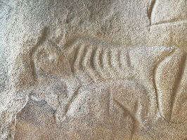
We find non vowel Ogam inscriptions in the Anubis Caves of Oklahoma as well as an artistically produced figure of a starving bull. Another figure shows a ship that is definitely not Viking. More Ogam can be seen in Ardmore, Oklahoma as well as Kanopolis, Kansas, which also boasts a Chi Ro. Ogam inscriptions are also quite common in southern Colorado and even into New Mexico.
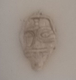
There is a Celtic face on a cliff side in Tulsa, Oklahoma while nearby is found a small stone carving of another face, this one bearded.
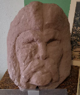
At Bache, Oklahoma a tablet with script reading from right to left is examined by Farley and Fell. A life size terra cotta head found there in 1943 by J. W. Hawkins was also examined by Fell who stated it to be the grave marker of a Celtic chieftain. In hinge Ogham on the side of the head is the epitaph 'Here at rest Haga Haga'. One test that might be of great interest is to have this sculpture x-rayed to see if there is a skull inside.
Another tribe of Celts seems to have settled in West Virgina. Burial #54 at Cresap is of a man 7' 4" tall. At Triplett Creek, Braxton county a sandstone tablet was found in 1931 that stated 'The memorial of Teth. This tile his brother caused to be made.' At Moundsville the Grave Creek Stone is discovered in a mound in 1838. It reads 'Tumulus in honor of Tadach. His wife caused this engraved tile to be inscribed.' A skeleton 7' tall was found at 60" depth next to the tablet. Earlier, two others mounds opened in 1834 contained ivory beads, copper armbands likened to an Egyptian style and two small tablets bearing a cross and Thors hammer.
It is well known that the Celts were a headhunting culture. Throughout the world headhunting people are generally affiliated with cannibalism and it is very possible this was the case here as well. We look at several native American legends, primarily those of the Kiowa and Paiute where there is a war against six toed, red haired, cannibal giants and their eventual demise at the Lovelock Caves, Nevada.
Here is an interesting link on some of these mystery stones:
December 15
CHRISTIANS
Christians also fled to the new world.
The Scotford finds of 1890 in Edmore, Michigan, were a result of clearing land and digging up old mounds between 1890 and 1910. Ultimately a vast amount of fantastical finds, over ten thousand items, mainly copper artifacts, clay tablets and beveled slate plates, were uncovered.
If one examines these artifacts the first impression one gets is the almost cartoon like characteristics of the drawings.
When Scotford began to display his finds, interest soared and before long he had gathered a number of collectors. He would even lead many interested buyers to mounds where they would dig the artifacts themselves.
The theory of the time was that due to the persecution of the Roman Empire, a group of Coptic Christians from Egypt migrated to North America. This timeline would place these relics in the AD 250-300 era. Egyptian is suggested by many of the motifs and styles as well as the portrayal of elephants.
Interestingly, the first relics of this style are reported elsewhere in 1869 by a completely independent source.
My guess is that some of his original finds were genuine but the popularity and monetary gain from these items caused him to make reproductions for extra sales.
Here is a link with further information:
In South Point, Ohio a Terra cotta oil lamp was found and dated to between AD 400 and 800. It contained Eastern Mediterranean text that said 'The light of Christ shines for all'. You can view it at the Andrews University in Michigan.
Newark, Ohio has some circular earthworks with 8' walls and a moat that have been officially attributed to the Hopewell culture. A central Stone tower was demolished in 1860. But of more interest is the Decalogue Stone that was found there in 1859. It contains an image of Moses and lists the 10 commandments. Another keystone uncovered there with religious symbols is known as the Johnson-Bradner stone. It was discovered after the death of the original finder of the Decalogue stone. Both of these stones are on display at the Johnson-Hunrick House Museum in Coshocton, Ohio.
A Wooden figurine was found under a flat stone in Kanawha County, West Virginia in 1897. Known as the Kanahwa Madonna this 50 pound chestnut carving of a man holding a lamb has been carbon dated to AD 500.
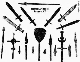
In Tuscon, AZ, in 1922 along the Silverbell road, 30+ items were found in a lime kiln gravel pit. This hoard consisted of crucifixes, plates, swords, spearheads and batons made of lead. Many were plated in copper, tin or gold and had latin inscriptions that told the story of Christians fleeing dark age chaos. The last entry was dated AD 880. The lead was extensively encrusted in caliche (age patina).
******
AFRICANS, SOUTHEAST ASIA, CHINESE AND JAPANESE
Several Negro male skeletons carbon dating to circa AD 1250 have been found in the US Virgin Islands.
Mexico too has turned up its fair share of bones but also much more. The massive Olmec stone heads bear unmistakably Negroid features as do many murals, terra cotta sculptures and pottery.
Rumors of an ancient 'Black' land come from the Carolinas, Louisiana, Mississippi, Arkansas, Oklahoma and Texas.
We see elephants as a footprint of cultures from India and Southeast Asia. These images have turn up in the Yucatan Peninsula of Mesoamerica. There are elephant images at Rock, Grant and Vernon counties in Wisconsin and previously we displayed a photo of an elephant or mammoth underwater at Traverse Bay. An elephant and a bristly creature are carved at the Anubis caves in Oklahoma. In Iowa images of elephants show up in Alamakee and Lansing counties as well as at the Earth Effigy Mounds. The Davenport Tablets contain elephants and in 1880, in Louisa county one featured on a Mississippian Culture stone pipe was plowed up.
The Japanese make their presence known in the Effigy Mounds of Iowa. A bronze bear with Oriental characters on it was discovered in 1840. In Washington State, iron blades with bamboo shafts have been found.
British Columbia and the Pacific Northwest are a good source of Jade. This drew the Chinese and many Chinese PCE coins have been found there. Further south we find an inscribed plate in California and Chinese characters show up in many pictographs across the southwest including in Sedona and the Grand Canyon. There are even reports of ancient oriental inscriptions at Walnut Island, Pennsylvania.
Most interesting is a report that a Chinese Emperor sent 3000 convicts overseas to 'Fu Sang' as sacrifices for a volcano god. Could this be Popocatepotl of the Aztecs?
******
MADOC
The Welsh Prince Madoc was said to have emigrated with his followers to the new world in 1170.
Searches for his descendants were quite common in the nineteenth century. Experts were hired to cross America to seek any traces of Madoc. Students of Welsh dialect claimed to have found descendants in eastern Siouan tribes, the Monacan tribe of Virginia, the Dolo tribe of Virginia, the Mandan of South Dakota, the Zuni of New Mexico and the Modoc of Oregon. Although it is possible that Madoc and his followers assimilated into local native tribes there is also the likelihood they met their demise from hostiles, disease or environment.
In Louisville, Kentucky, breastplates displaying mermaids & harps were found in the early 1800s. Nearby was a severely weathered tombstone dated 1186. Six skeletons wearing mermaid and harp armor were found in Jeffersonville, Indiana in 1799. Another report claims six skeletons wearing mermaid and harp brass armor were found in 1792 in Jefferson, Missouri along with a stone tablet that read in latin: virtuous deeds meet their just reward. Could these previous two examples be the same?
In Charlestown, Indiana, stone ruins surveyed by K. T. Cox, a State Geologist in the 1870s were identified as stone fortifications. Known as the Devil's Backbone, they were identified as a possible settlement of Welsh Prince Madoc as are stone wall fortifications known as Fort Mountain in Chatsworth, Georgia.
Plowed up in 1912 by Craig Crecelius in the district of Paradise Bottoms, Battletown, Kentucky was a 27" limestone fragment also known as the Brandenburg Stone. It read, in Cumry (Welsh script): 'Towards strength, divide the land we are spread over, justly between offspring and wisdom.'
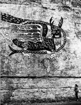
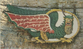
A very curious rock painting from Alton, Illinois known as the Piasa Bird is claimed by some as being the forerunner of the Welsh dragon and a legacy of Madoc. Explorer Jacques Marquette first sighted and reported the rock painting in 1673 during his journey down the Mississippi River. An early drawing was done by the German artist/scientist Henry Lewis after he toured the Midwest in the 1850s. Native American legends said this creature had a cave nearby and that it would swoop down and attack unarmed travellers. The pictogram was meant to be a warning and it was described how passers by who journeyed up or down the Mississippi would shoot arrows or firearms at the image to deter the beast.
By the 1920s the pictogram was almost worn to obscurity so it was decided by the locals to repaint it. Later due to road construction this image too was becoming inaccessible. In 1984 a metal Piasa Bird was constructed and placed nearby.
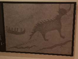
There is a strong similarity to the Objibwa Mishipizhou (Great Lynx), a more northern mythical native beast claimed to be a water spirit. A clear carving of this creature can be seen at the Agawa pictograph site in Lake Superior Provincial Park, Ontario.
******
Here are a few more interesting links. Thanks again Tom:
******
May I wish the best to all in this holiday season, whatever you may celebrate. Slava Ukrainia!
....to be continued.