Vinland Blog Archive
Introduction
I have always been interested in the Vikings, especially their visits to North America and the encounters with the natives (Skraelings). As if to spur this on, I was commissioned to build a model of a Viking Longship for our Local Scandinavian Cultural Center. Near the same time I obtained a copy of the book Westviking by Farley Mowat (1965) and after reading it, Peg and I decided to take a vacation to Newfoundland where we would visit L Anse Aux Meadows, the only verified Norse site in North America. What we found there and the subsequent results of my research is remarkable.
2011-2017
Wednesday August 17, 2011
Boarded the ferry to Newfoundland this morning. Landed at Port Aux Basque in the afternoon. It was like landing in a completely different country. The geography was astounding and we immediately fell in love with this rugged and beautiful land. Drove to Deer Lake where we checked into the B and B we had reserved. Tomorrow we take the Viking Highway to L Anse Aux Meadows. As we rested in our room, I read Westviking for the twentieth time. Farley had stated that there had been more than one Norse settlement established and looking at the road map, realized we were within 70 kilometers of Hampden, which he suggested was a possible location for Hop II.
(Now, as an aside, I had missed the Gettysburg Battlefield by 75 miles on an oversight when I went to research Woodstock. Ever after regretting the missed opportunity of sating my historical delving, I was not going to miss a possible site again!)
Since we would have a bit of time the next day, we decided to go there simply to look around. We would still make St. Anthony by night.
Thursday, August 18, 2011
The highway from Deer Lake to St. John's is well kept and we anticipated a smooth drive to the turn off to Hampden. As I enjoyed the scenery I spotted a tiny sign at the side of the road. It stated 'Viking Museum' Sops Arm.
I quickly checked our road map. Sop's Arm was only 30 kilometers past the intended target. Should we chance it? It might throw our scheduled arrival at St. Anthony off by an hour or two. With the foolish insistence of the ever inquisitive I managed to convince my partner to journey just that bit farther, not a difficult task considering her to be of like mind.
|
| The 'Hop' at Sops Arm. |
A couple more curves of the road brought us to the town itself, spacious and rustic in the typical Newfoundland fashion where a drive through the settlement, searching for our goal, seemed to take forever. A building displays a large sign and we pull up to another dismaying sign that states 'Closed for Renovations'.
Needless to say, having driven almost a hundred kilometers, I was greatly disappointed. We got out of the car to stretch and view the area. Before I knew it, Peg was talking to a woman that had come out of a door at the side of the building. Her polite inquiry of assistance led us to explain our mission and she kindly offered to let us look at the museum. We accepted quickly.
We waited impatiently for several minutes before she came back with keys and happily followed her into the museum. It was like many I had been in before across the continent. A small, rural museum with a few showcases of artifacts and walls full of data. My kind of place.
The showcases contained mainly metal objects. A large stone was at the far end of the room in a bright area. The walls were covered with documents, photographs, maps and paintings. As we walked through the room we learned of the history of the place.
Having dealt in antiquities in my younger days, I immediately recognized several of them. Although a number of the items were readily identified as comtemporary, there were a few that could easily be determined to be quite old based on their patina. Other items of wood, bone, stone and cloth peppered the cases. Sizes ranged from bits to a large part of an anchor mounted against the wall. We were allowed to photograph the displays and pressed on. It was already almost mid-day and we had to make St. Anthony.
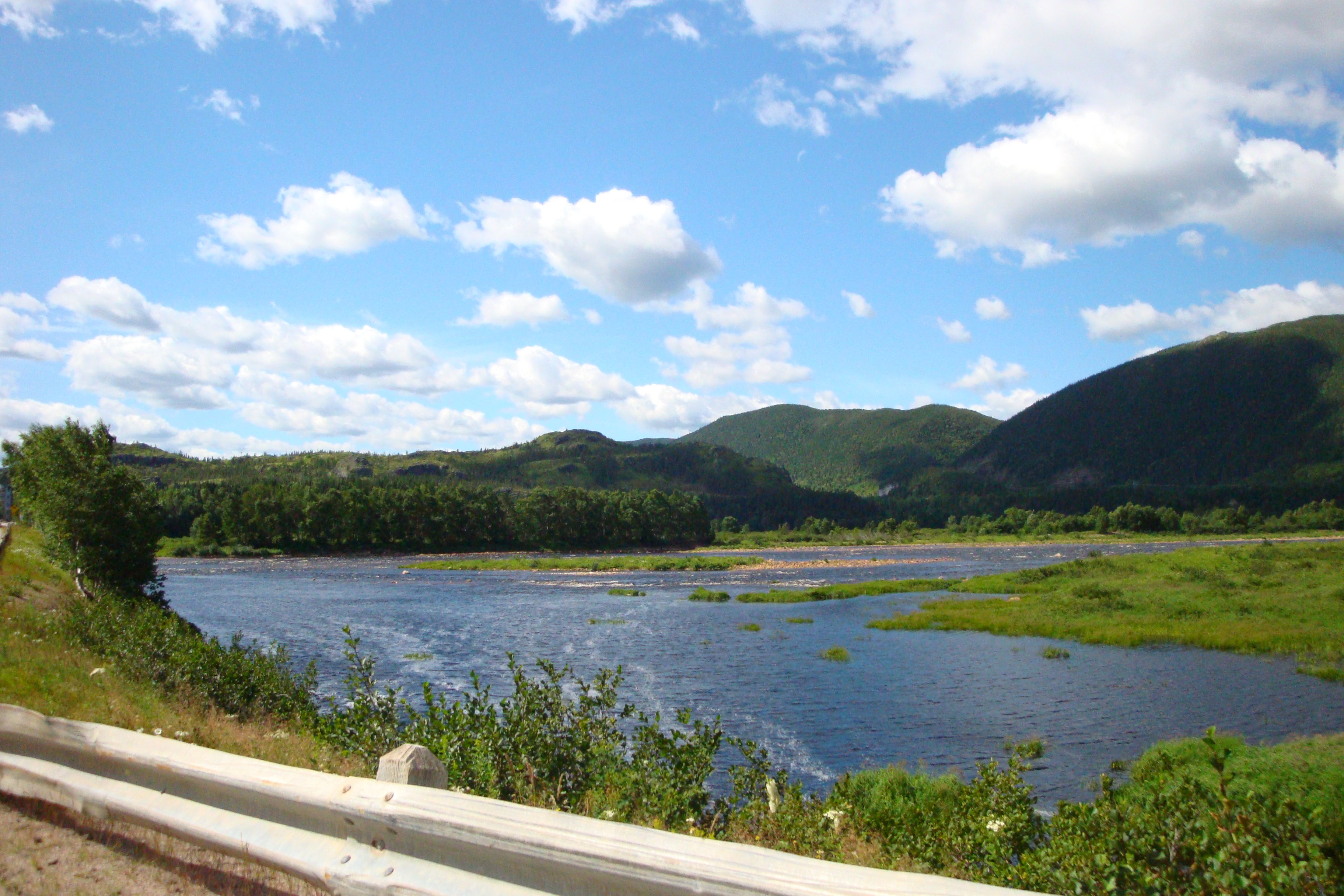
We made some good time on more excellent roads and got to view the splendour of Gros Morne, having lunch in Cowhead. Looking out across the water, I wondered if Knorrir had been here, the point thick with a shoal of nesting birds.
Continuing north along the Viking Highway, we went through some incredible terrain changes, from heavily wooded mountains to bleak, featureless coasts, a particularily long one sporting a quaint Newfoundland village every five kilometers. We crossed the peninsula and made it to St. Anthony at dusk, our supper at the local point gratifying. Going to sleep at night, the mystery of Sop's Arm puzzled me and infected my dreams.
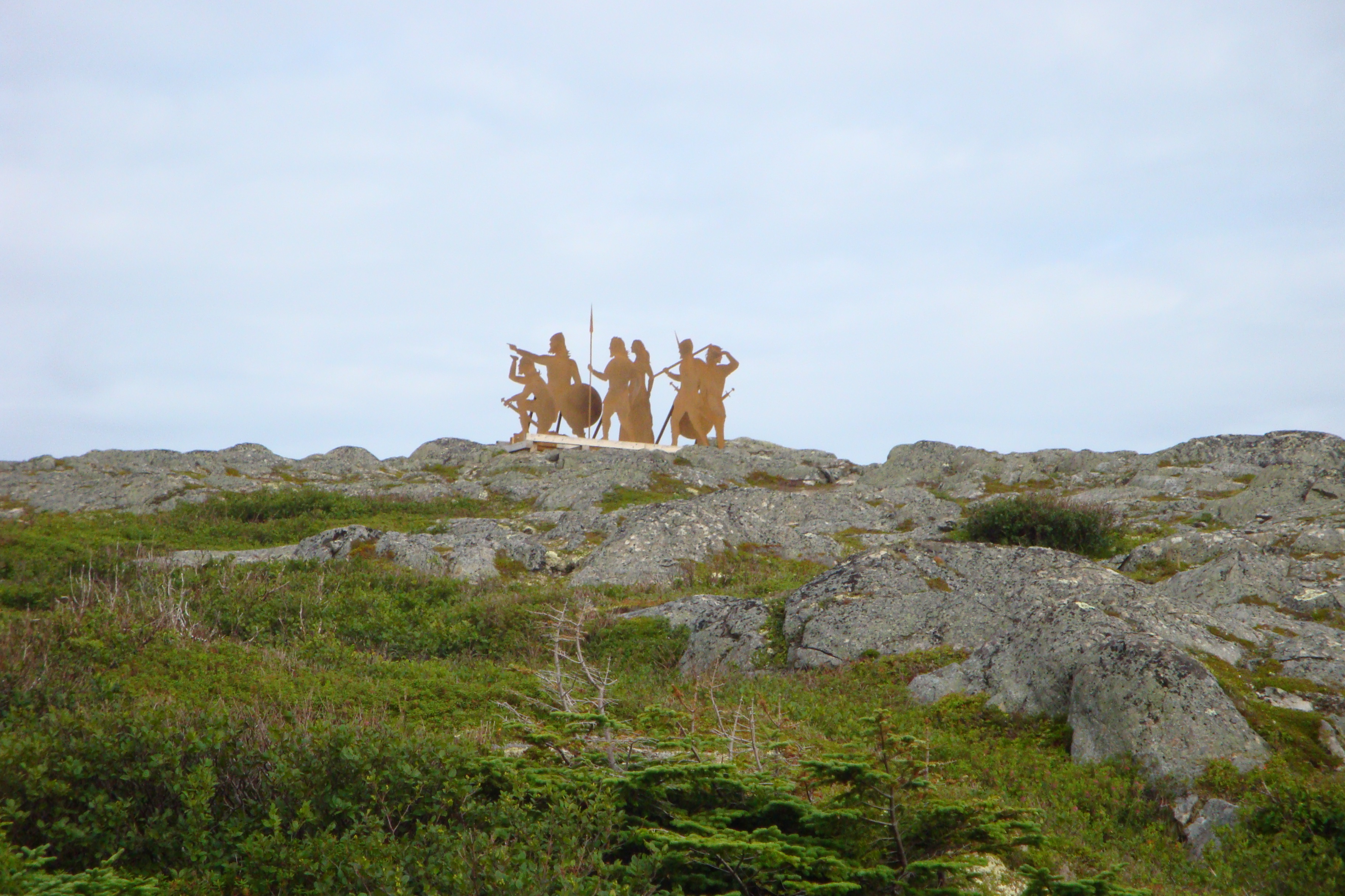
|
| Arrival at L'Anse Aux Meadows. |
Today was the day. Our visit to L'Anse Aux Meadows and the major purpose of our trip. A quick viewing of the icebergs in the ocean at St. Anthony and a winding road through more small villages eventually landed us in a parking lot at the base of a hill. At the top a group of viking silhouettes graced the horizon. A valley on the other side of the parking lot housed a moose and her calf, our only sighting of these reknowned provincial denizens so far on our visit. We followed the walk to get to the visitors center.
The entrance gave credits to Ingstad while the sagas and a mannequin pair of warrior and lady greeted us at the door. The visitor center was all that I expected, and more. Artifacts, ship models and detailed explanations. A wonderful diorama of what the settlement would have looked like a thousand years ago and a well populated gift shop. Was this indeed the Straumsfjord of the sagas?
We had allowed plenty of time for this stop and I am glad we did. Peg had to keep me moving or I would have spent an hour at the front of the building trying to read the sagas. A project for later.
We watched an orientation movie and had much deep discussion with many knowledgable people. Some of our opinions even got us labelled as 'Farleyites' to which I proudly said "Yes." then "No." Could it be possible the great writer was incorrect?
It was a cool, bleak day. What the Norse would have had to put up with for the majority of their time here. We walked the paths to the longhouse mounds and the 'large booth' rebuilt by Parks Canada. It was a pleasant place to warm up in while viewing the many facets that made up the daily life of the Norseman.
A further, closer look at the mounds and then a walk along the shore followed. It was a rocky and hazardous path that we took for some ways before turning back. Was this the path that Freydis Eiriksdottir walked when she went to visit the brothers Helgi and Finboggi? I enjoyed a plentiful sampling of wild Bake Apple berries along the way. Somebody had said that they tasted like a cross between an apricot and honey. Although I could not particularly agree with that, I will readily admit that they have their own unique pleasant taste. Still, not something that one would really want to make wine out of. Or would they?
As we approached the visitor's center I took a last, long look back towards the site. Great Sacred Island displayed bold, red ochre cliffs in the distance that I at once recognized would be a significant landmark to any seafarer. As a matter of fact, this island was actually mentioned by Farley in his book. I purchased some literature at the gift shop and we departed to visit Norstead, an absolute must while one is here.
First a hearty, slightly late lunch at a local restaurant and then on to the Viking port of trade. Norstead is a replica Viking village, chock full of buildings populated by re-enactors and replica artifacts. Nicely done and very authentic. The pride of the village has to be the full scale ship THE SNORRI.
This well constructed replica was built by Robert Stevens and sailed from Greenland to Vinland in the precise path of Leif Eirikson. The knarr arrived at LAM (L'Anse Aux Meadows) on September 22, 1998 after a two month voyage. It was subsequently donated to Norstead.
It was a delight to view this wonderful beast. It featured 2500 nails throughout the hull. Something that I thought would replicate nicely in the model I was working on for the SCC (Scandinavian Cultural Center). I admired the rudder, taking in the craftsmanship and thinking about how I would be rebuilding it in miniature. We toured through the village and then on to the road to Port Aux Choix, our next stop.
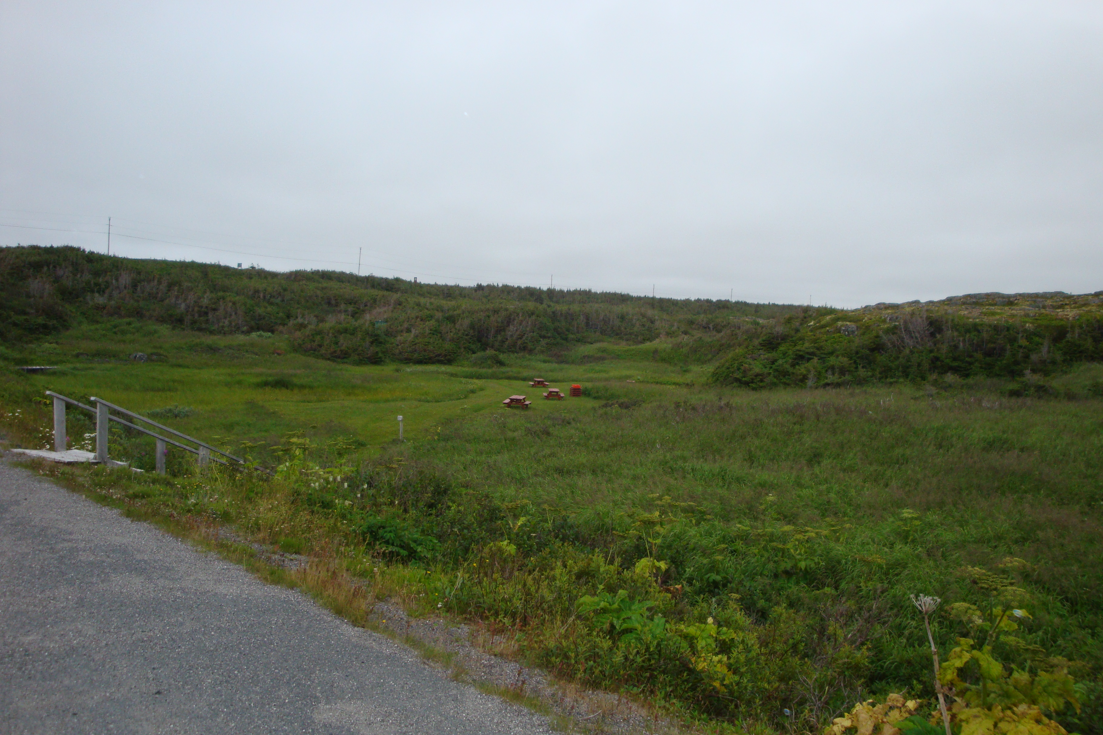
|
| A nice picnic area in the gully at Caplin Gulch. |
As I got out of the car rain fulfilled the threats it had been promising us all day and it began to sprinkle. Undaunted, I toured the area. If one were to winter in this land, this would be an ideal place to do so. A bay, facing roughly Southeast and a little meadow with fresh water, protected by low hills on three sides.
Add to that the fact that LAM was just over the hill.
A very old saying is: "Keep your friends close and your enemies closer". A saying well adopted by suspicious vikings. If I were the brother's Helgi and Finboggi, I would seriously consider this area. Not only is this little spot a prime wintering location but it is well within walking (and watching) distance of the only other people in the area. People not on the best of terms with. An easy journey for a barefoot Viking woman. Did a massacre take place here?
The rain increased and we drove on, the rest of the afternoon occupied with driving to a Dorset site. Once again, the long beach known as the French Shore was ours to view. Peg drove and I watched. I thought. There was definitely more to Vinland than just LAM. I would have to look into this further.
We arrived at Port Aux Choix and spent a relaxing evening touring the harbor. The reading that night was Wineland Voyages by W.K. Munn. This work is essentially the primer for any serious Vinland research. A short booklet, originally self printed as a pamphlet, it expounds the author's theories as to where Vinland was located based on two sagas. That of Eirik Raudr (ERS) and The Greenlanders Saga (GS). The two epics provided enough information to locate LAM but what about the rest of the colony? I also managed to take a glimpse at another vital reference work, Vinland Revisited. This is a compedium of the papers presented at the Viking Millenium International Symposium and has some incredible information not only of Vinland but of the Norse in general.
Saturday August 20, 2011
The lighthouse at the point was our first stop. We were privileged to view seals and caribou. Then on to the Dorset Museum just down the road. A portrait of a Beothuk and a subterranean lodge rang true to the sagas. We ended our visit to Port Aux Basques with a quick tour of the graveyard then on the road to have a late lunch at Cow Head.
After our meal we decided to look around St. Paul's Bay, mentioned in Farley's book. We drove through the town and wondered if this was the headland where the Skraelings were encountered. Crossing the bridge, we stopped at the boat ramp and within minutes of walking along a rocky shore came upon a stone which fit the description in Westviking. Another batch of photographs were taken and then home, our visit to this incredible island ending with a two in the morning ferry appointment.
Sunday August 21, 2011 onward
We left Newfoundland with more questions than answers. Answers that were only partially alleviated by detailed studies of numerous reference books and materials in the following months. There occurred careful viewing of the photographs we had taken and extensive research of many, many museum photographs from both LAM and Sops Arm. A complete study of the Norse culture was of valuable assistance. A bout of emergency back surgery allowed me some downtime in which to do my studies.
January 5, 2012
A long, 800 Kilometer drive to Saskatoon and plenty of time to think. Lots of reading behind me. I had just finished Birgitta Wallace's Westward Viking. A detailed and excellent synopsis on LAM. This work became the Rosetta Stone of my research.
The primary purpose of LAM was for a ship repair. It was also determined that it was a jumping off point for a return trip to Greenland. The amount of off island materials that were found gave existential proof that the Norse had voyaged much farther into North America than this place. Signs of many of the indicators of long term habitation were not present. There was no graveyard and very little in the way of mammal bones although the length and duration of the settlement seemed to indicate a number of years of use.
Now that we knew the exact details of the only known Norse settlement to date, right down to its very uses and purposes, we could ask the prime and groundbreaking question: Where does LAM fit into the oral histories of these people? Where is it in the sagas?
During my entire trip these questions kept running through my mind, then became synonymous with a single line from the sagas: 'and they stayed there a long time repairing their ship.' As I recalled more about this passage, my questions began to be answered. By a simple analysis of the Norse voyages to Vinland, in chronological order, the placement of their settlements could be discerned. It was appearing that the sagas could give us directions to three more sites in Vinland. It was with excited realization that the path I must take was shown to me. Peg and I had already discussed the idea of my writing a book about the potential answers to the Vinland mystery. But first, another careful review of the sagas, word for word.
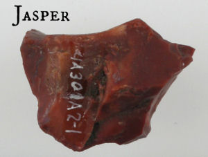
|
| The Jasper Fragment from Notre Dame Bay |
I was fortunate enough to borrow a copy of The Complete Sagas Of Icelanders by Leifur Eirikson Publishing. This work contains the most complete and accurate English translations of the Icelandic sagas including the ones relating to Vinland. An earlier translation of the GS titled the Hauksbok version, is known to contain some errors. Nevertherless, it too contains valuable information especially in its detailed descriptions. Weeks of hard study followed.
February 18, 2012
I feel that I have read GS and ERS a hundred times. The book continues to take shape and all my theories are showing proof of being correct. Now we have it. The more we assign this location to LAM the more details begin to ring true. This settlement, named Kjalarnes in both sagas became the focal point for the following studies. Like a picture out of focus suddenly becoming clearer or like a printed photograph with color misaligned and placed back into synchronization, everything began to fall into place.
April 21, 2013
Kjalarnes Found is completed, copyrighted and into rewrites.
January 8, 2014
The recent upsurge of interest in the Viking and related cultures that I have observed over the last several months is quite amazing. Facebook discussion groups whose members once numbered in the hundreds are now running several thousand. Can we credit this tidbit to the television series 'Vikings'? Most likely but not exclusively. There must be something else afoot.
Irregardless, what really prompted me to write in here tonight was an article that I read in the Viking News Annex. The credibility of the sagas continues to be validated, this time through the interlinking of characters. Of course, not a surprise. Our own two sagas, GS and ERS do this quite readily. In fact, the reference to King Olav Tryggvyson even gives us a timeline to work with.
February 27, 2015
Since I wrote of my previous finding and having had discussions with many people, The Sops Arm Site is now without question widely accepted as a genuine Viking site. It only remains to be determined which one it is. I have expressed my opinions on this matter in Kjalarnes Found. The general consensus is that Parks Canada is fully aware of the site but simply does not have the resources available to expound Sops Arm. It will be up to private enterpreneurialship to do so. Any adventurers out there?
I was able to obtain a copy of Helge Ingstads book Westward to Vinland. In Chapter 20 he indeed confirms his investigation of the area and the caribou pits there. For anybody who wants to read about it; page 208.
March 29, 2015
Today I had the pleasure of completing the reading of Vinland Discovery - The Unfinished Story written by Kent Budden. Kent was principal in bringing the Sops Arm Site to the forefront. His book explores the Sops Arm area and relates it to the sagas. Most importantly, Kent gives a description of the site along with a hand drawing (figure 5). Most specifically this illustration shows the gravesite of a high status Viking. The grave of Thorvald Eirikson.
But then of course, we knew this all along.
May 10, 2016
I can't believe it has been over a year since I added anything to this blog. There have been so many important things happening recently in regards to Vinland that I have a lot to fill in. So here goes...
From Archaeology News - June 8, 2013. A piece of Jasper from L'Anse Aux Meadows has been found to originate from the Notre Dame Bay area of Newfoundland. This now gives absolute proof that the Vikings travelled to the east coast of the province. Since Notre Dame Bay is only a hop, skip and a jump from White Bay and Sop's Arm it gives more weight to the theory that Thorvald Eirikson was in this area.
Kent Budden's second book, Vinland Discovery - The Unfolding Story is a continuation of his explorations of the Sop's Arm area. In it he details some of the beaches he searched and the items he found. Although in his first book he is adamant that he has found Straumsfjord and he attempts to associate the site with various pieces of information, his second book deals more with what he has actually found.
He details and photographs many stone and wood structures that were interesting or unusual. Some of these are quite fascinating as they display man made shaping and carving. Some have mooring holes cut into them. One particularly interesting stone has a clear carving of a seal or a serpent as well as having a mooring hole.
It is important to note that the mainly metal objects that Kent took back and displayed in his museum (other than the rune stone) were beach finds, exposed or partially exposed by the elements. They would be similar to those taken decades earlier by Mallery and the British Museum. (Of which we will cover at a later date).
What we know so far of Vinland is just the tip of the iceberg. The water is receding and the rest of the iceberg is beginning to show. With great excitement I anticipate the next few decades and what is about to be revealed about the Norse visitations to North America. History as we know it today is about to change drastically.
May 19, 2016
Over the past several months I have had the pleasure of meeting and working with Owen Budden, the brother of Kent.
Kent passed away of cancer in 2008 which sadly left his museum at Sop's Arm in limbo for a period. It is now Owen's intention to take up the torch and resume where Kent left off. His first plans are to rewrite Kent's books modifying them to reflect recent information and take a more analytical approach to Kent's findings. His book entitled More Than Geograhy And Grapes is in the writing stage. Owen has asked yours truly to edit it of which I have accepted the offer.
A Danish periodical, Acta Archaeologica in Volume 83 from 2012 features an article called Falling Into Vinland co-authored by J�nas Kristj�nsson, Bjarni F. Einarsson, Kristj�n J�nasson, Kevin McAleese & Thor Hjaltal�n. This article details the examination and partial excavation of the caribou pitfalls at Sop's Arm. Although carbon dating was inconclusive these gentlemen are of the opinion that these pits are Norse.
Another area of interest is Nanook on Baffin Island. Archaeologist Patricia Sutherland has discovered some fascinating Norse artifacts from the fourteenth century there. You can read about them at:Patricia D. Sutherland et al. Evidence of Early Metalworking in Arctic Canada. Geoarchaeology, published online December 1, 2014. Strangely, Sutherland's work was abruptly terminated by Canadian officials. Could this be because they didn't want anything competing with the Franklin Expedition finds?
June 2, 2016
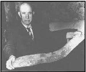
Where to begin tonight? I think at this point in the blog we are going to start looking at Arlington H. Mallery and his involvements with Vinland. Mallery was born in 1877 and passed away in 1968 at the age of 91. He was a professional engineer and served with the US military through 3 wars, the Spanish American War, World War One and World War Two, where in his 60's he captained a cargo ship during the Battle of the North Atlantic. He was also involved in espionage in the Pacific where he was wounded in action against the Japanese. He was fluent in Latin, Greek, Icelandic and Norse.
Mallery took great interest in the Norse sagas and began doing extensive explorations in the Newfoundland and Labrador areas before he was interrupted by the second world war. After the war he continued his explorations moving on into Virginia, Indiana, New York and Ohio.
|
| Arlington Mallery holding a piece of pre-Columbian iron slag |
HIS THEORIES INCLUDED:
-The Norse visitation to North America before Columbus
-That 'Vinland' was Newfoundland
-Extensive Norse colonization of the eastern seaboard
-Pre-Norse Celtic colonization in the Gulf of St Lawrence and further inland called Vitramannaland
-The Newport Tower (Rhode Island) is of Celtic origin
-Pre-Columbian iron forges in Ohio
-A Pre-Columbian stone fortress at the Spruce Hill site
-The emergence of the Iroquois Confederacy as a hybrid of Norse and Aboriginal peoples
-The genuinity of the declared fake Kensington runestone
-The discovery of Antarctic pre-ice coast lines in the Piri Re'is map of 1513
His studies resulted in the publishing of his book Lost America in 1951 and a rewrite entitled The Rediscovery of Lost America by Mary Roberts Harrison in 1979. Both issues contained introductions by reknowned ethnologist, archaeologist and Smithsonian administrator Matthew W. Stirling. The fact that Stirling was willing to write an introduction definitely adds some respectability to Mallery's opinions. It is interesting to note that although Stirling readily admits in his introduction that he may not neccesarily agree with many of Mallery's theories he infers that he does tend to agree with the concept of Celtic/Norse habitation in North America beyond that of the Sagas.
As time goes by many of Mallery's theories are being taken a little more seriously and some of them are actually now becoming fact. The Norse were here before Columbus. Vinland is Newfoundland. Mallery's explorations have spawned a second generation of research with the former Archaeo-Pyrogenics Society (APGS) in the early to middle 1990s. The APGS was formed by David Orr of Ross County and William Connor to excavate and scientifically study the furnaces and artifacts found in association with them. Connor has also written a book entitled Iron Age America and provides some very interesting information on his website America's Mysterious Furnaces.
It took over fifty years before Munn's theories on Helluland, Markland, Furdustrandir and Vinland bore fruit (grapes?). It now seems another man's theories are doing the same after another fifty years. I certainly hope this time span does not set a precedence. More on Mallery and his finds in my next writing session.
June 15, 2016
Regardless of what one's opinion of Arlington Mallery is, whether he is considered as a quack or a sage, the research, information and suppositions he has provided in his two books: Lost America and The Rediscovery of Lost America has certainly provided some serious points to ponder. Tonight I would like to examine what he did at Sop's Arm.
Before World War Two, Alf Budden, then Postmaster at Sop's Arm, directed Mallery to several sites at and around Sop's Arm where he assisted Mallery with excavations. After the war Mallery returned and in 1946 found several iron artifacts. I believe he did some test digs but most of what he found can be labelled as 'beach finds'. Sgt. Marie Christianson of the Newfoundland Rangers helped with the overseeing of this project and the preparation of manuscripts.
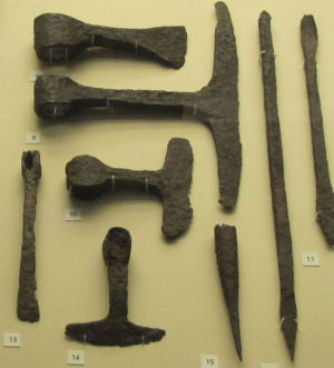
|
| Viking ship building tools in the British Museum. Note the chisel at extreme right. (#11) |
Extensive testing of these artifacts followed. They were submitted to C. J. Horwitz, Technical Director of NY Testing Labs Inc.for metallurgical and chemical analysis. They were also submitted to Paul Mallery, Electrical Engineer at Bell Telephone Labs for spectroscopic analysis. In addition they were examined by Dr. Clark Wissler and Dr. Nels C. Nelson of the American Museum of Natural History. Carbon 14 data testing results by Dr. Sterling were published in Science on February 2, 1951. A photograph of the axe head was printed on Page 134B of Lost America. The artifacts were found to be of carbuerized wrought iron as was typically found in Greenland and Scandinavia. Sadly, many of the iron items disintegrated. Mallery states this was due to iron impurities as would be typical for iron manufactured from bogs.
As for the site or sites, Mallery believed he had discovered 'Hop' of the sagas. He also theorized that there was additional occupation of this area. The 1946 beach finds (Iron chisels, boat spikes, clinch nails, battle axe, stone tools and spearheads) were found near 11th century longhouses. He also found what he claimed to be remnants of later 14th century longhouses (35 foot width). All in all, he believed that Sop's Arm was a settlement from the 11th to the 14th centuries. He suggested an increase in occupancy after 1200 which may have been an infux of post-saga Danish colonization. The inhabitants were thought to be seamen or fishermen but could have also been hunters of caribou, seal or whales.
Mallery stated to have found no occupancy after 1400, claiming the settlement abandoned and citing the Black Death as the cause.
My initial thoughts on the Norse expeditions to Vinland were the same as those of many other scholars. The Sagas were the truth, the whole truth and nothing but the truth. It was inconceivable that there were other visitors who explored or made colonization attempts. However, Arlington Mallery, with his findings and theories, be they valid or no, has definitely expanded my horizons beyond saga evidence. One must consider that the sagas are reports from the Norse who made it back from Vinland. What about those who didn't? Perhaps some considered Vinland to be of such value that any visits were kept a secret. Alternatively, what if expeditions to Vinland became so mundane they were not worth reporting?
There is definitely more to Sop's Arm than Thorvald Eirikson's grave and there is definitely more to Vinland than the Sagas.
July 5, 2016
In his book The Farfarers Farley Mowat also adopts Mallery's theories that the Albans arrived in North America before the Norse. Tracing these peoples back to pre-Roman times, Farley chronicles their migrations in the typical pattern of peoples being expelled from their homelands by a more aggresive or warlike people. Forced from Gaul to Ireland by the Romans (where they become Christian) they then emigrate to Scotland, Northern Scotland, Iceland, Greenland, Labrador, Vinland and finally into the Gulf of St. Lawrence where they establish a colony named Vitramannaland (white man's land).
Mallery mentions the excavations of Junius Bird in Labrador. Bird analyzed and catalogued many stone tools he claimed to be of European origin. Mowat goes a step further, taking a closer look at the findings on Pamiok Island (Ungava Bay). What appear to be stone longhouse foundations are present as well as numerous stone cairns in the area. Some graves appear to contain European skeletons.
Mowat describes numerous other cairn sites throughout Labrador and Newfoundland with inferences that these were Celtic signal markers providing directions to settlements.
Although these rock piles can positively be attributed as man made, the main question is are they Aboriginal, Celtic, Alban, Viking or post sixteenth century European. The Vinland mystery deepens.
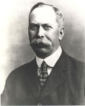
|
| W. A. Munn, author of Wineland Voyages (1914) |
Before moving on from Mallery I would like to point out several gleanings from his two books Lost America and The Rediscovery of Lost America. These small bits and pieces are certainly worth pondering.
Mallery elaborates on his post saga colonization theory inferring that the migration was caused not only by overpopulation but by the onset of the Bubonic plague in Europe. Inevitably the plague followed the colonists to Vinland and is the cause of their disappearance. He even goes on to say that the colonists were Danish and numbered somewhere between seven hundred and one thousand people.
Mallery states that not only have European stone tools and artifacts been found in Labrador but Newfoundland as well. There has been Viking pottery found in Hopedale, Labrador. Longhouse foundations have been found at Englee, 60 miles north of Sops Arm. He mentions that artifacts of various types have been found in seventeen locations in Newfoundland. One of his more interesting comments is (in his discussions on the Kensington Runestone) that a Viking sword and shield boss were found near Lake Nipigon and that they currently reside in the Royal Archaelogical Museum in Toronto (the R.O.M.)
One of his more interesting theories has to do with the disappearance of the Norse and/or Alban settlements in North America. As he states, the Black Death virtually wiped out these colonists but according to Mallery the survivors intermarried into the aboriginal populations. The appearance of the Iriquois tribe in the fourteenth century leads to some remarkable comparisons between them and their Viking neighbors. We have longhouses, compensation for killings, matriarchal ways in the areas of property ownership and divorce. Most surprising is the comparision of loan words between the two languages. My favorite is the word 'Loki'. In Iriquois, this translates as 'devil'!
Arlington will make cameo appearances later in several other Vinland related subjects to be covered.
November 3, 2016
Here are some facts to consider when making a study of Vinland:
-Medieval fires have destroyed church records in Iceland and Denmark.
-In 1054 an Irish Christian bishop by the name of Jon was apparently killed in Vinland.
-In 1117 Bishop Henricus of Greenland went to explore Vinland. He stayed for a year before returning. (ref: Yale Map)
-In 1121 Eirik Uppsi was appointed as Bishop to Iceland. He equipped a ship and sailed to Vinland to convert the Skraelings to Christianity. In 1124 a new bishop was appointed.(ref: Icelandic Annals)
and...
In 1347 port records from Reykjavik, Iceland record the arrival of a Greenland ship returning from a lumbering expedition to Markland, having been blown off course. What is most interesting about this is that the reporting is so casual it would indicate expeditions to Markland to be a common occurence.
November 8, 2016
Here is an item of interest that I promised to expound upon on May 10th.
In the 1963 Summer edition of the Newfoundland Quarterly a small article states that two chisels and a battle axe were provided to the British Museum. They were listed as 'beach finds across from Sop's Arm'.
I imagine this article was lost in ignonimy as at the time, LAM had the headlines and everybody was expecting much more spectacular results there.
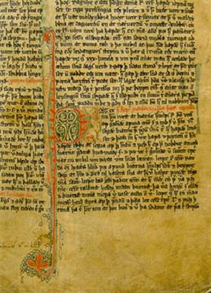
|
| The Greenlanders Saga |
Tonight I wish to examine the theory of pre saga Viking colonists to Vinland. Those who landed there and never made it back to chronicle their adventures. I am using The Saga of Eirik the Red: ERS, The Eyrbyggia Saga and the Landnamabok (The Book Of Settlements) based on the writings of Ari (Thorgilson) the Learned.
In his attempts to colonize Greenland, Eirik Raudr convinced 25 ships worth of settlers, mainly friends and relatives, to go with him. Only 14 of the 25 ships made it to the new country. 11 ships were either lost at sea or turned back.
If we move forward momentarily for a few years we see in ERS that Bjarni Herjolfsson in a trip to visit his father in Greenland is blown off course in his journey from Iceland and ends up in Vinland. Therefore, it is not inconceivable that earlier colonists made landfall along a similar route.
To back this up the Landnamabok refers to a man by the name of Ari Marsson, a cousin of Eirik the Red. Ari was apparently blown off course and ended up in Hvitramannaland where he is kept there by the inhabitants. The Landnamabok says this place is six days sail west of Ireland.
The Eyrbyggia Saga refers to a Bjorn the Breidavik Champion. Bjorn goes to sea and is lost.(chapter 47) In about 1020-1028 a merchant by the name of Gudleif Gudlaugson is blown off course and ends up in a land located west of Vinland where he encounters Bjorn. Although held in high regards by the inhabitants of this country, Bjorn is not allowed to leave and he expresses to Gudleif that the merchant is in great danger and should leave this territory as soon as possible.(chapter 64)
Detailed studies of the Norse indicate they were a very resourceful people. They were self sufficient and with the right materials could produce practically anything they required. Marooned in a land as plentiful as North America they could gain easy access to their crucial needs: Water, wildlife, wood and metal (bog iron). The fact that they could establish settlements in a new land is entirely within scope. Their only concerns would be interactions with other peoples such as the Skraelings (Aboriginals) or the Albans (Celt/Irish).
On a side note, going through the Eyrbyggia Saga I found a reference in Chapter 48 stating that Snorri Thorbrandson was killed in battle in Vinland! Interesting how the Sagas, once considered as unrelated stories of fiction are now revealing glimpses into what was considered the 'Dark Ages'.
December 8, 2016
The number 8 always seems to be a good number for me. On August 8 of 2008 I completed Chapter 8 of Glacier. It contained 8,888 words.
Today, December 8, I am please to announce that I have completed a self-publishing book deal with McNally-Robinson Bookstore. They will be stocking Kjalarnes Found in their Winnipeg and Saskatoon outlets. The book launch is slated for sometime in March (2017). I will be pre-selling these books for $17.50 on the website. After book launch they will be $19.95.
January 18, 2017
The book launch of Kjalarnes Found has been confirmed for Thursday March 16 at 7:00 PM at McNally-Robinson Booksellers in the Grant Park Mall, Winnipeg. All are invited to attend. There will be a short talk with a question and answer session. Books will be available for sale there and I will sign them.
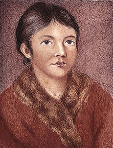
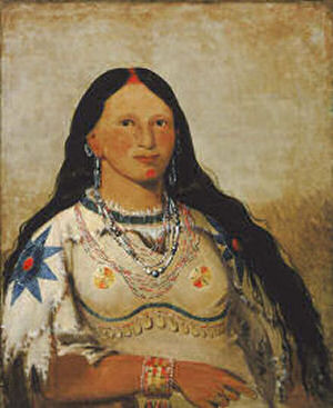
|
| A Beothuk. Watercolour on ivory miniature 'Portrait of Demasduit (Mary March)', by Lady Henrietta Hamilton, 1819 (Library and Archives Canada) |
In The Greenlanders Saga Thorfinn Karlsefni encounters a family of Skraelings. Although a man and two women escape, the Vikings manage to capture two children. They are said to be boys who are baptised and quickly learn the Norse language. They provide some details about their society but the most interesting bit of information they relate is about a people that live across the water from them. These people wear white robes, carry big banners and chant loudly.
The general consensus is that these people are Celtic monks and it was believed that the 'land across the water' was Ireland.
Here are some factors to consider: If these children were captured on the east coast of Vinland (Newfoundland) or anywhere in Labrador then 'across the water' would very likely refer to Ireland. However, that would mean that Skraelings made it to Ireland and returned to report this! Not a very practical scenario.
Alternatively, if the boys were captured on the west coast of Vinland, then across the water would refer to the Gulf of St. Lawrence and adds additional ammunition to the existence of Vitramannaland. That Skraelingen visited the St. Lawrence Seaway is a significantly more feasible concept, this being much closer and much more do-able.
On a side note, in 2010 it was released that Beothuk DNA trace elements were found in over 80 living Icelanders. These elements came from a single woman that was born no later than 1700. Mutations in some of these genes indicate dating further back and is estimated from around AD 1000. An article by Tracy Watson, National Geographic News, November 26, 2010 provides some excellent information on this.
Curiously, these trace elements can only be determined from the female side but according to the sagas, Karlsefni brought back two boys! Could the sagas have been wrong on this? It is possible. Skraeling children, whether boys or girls, could have been dressed similar in appearance and may have been reported as boys before the female gender was discovered. This would have been of less importance to the sagas, the number of warriors on a ship being a higher priority. These children would have grown up as slaves and eventually them or their descendants would have obtained freedom. They would have blended into the Icelandic population and thus the DNA results today.
Also, this negates any First Nations claims to remains or territory of the Beothuk people. Their direct descendants are in Iceland. Would this then mean that Iceland has a claim to Vinland (Newfoundland)? We had better not open this can of worms!
March 16, 2017
The launch of Kjalarnes Found took place tonight. A gloomy, rainy night but still twenty some enthusiasts came out. Books were signed, coffee and cookies offered. Thanks to all who came out. For all those that pre-ordered, the books will be shipped next week.
March 19, 2017
The mystery of the missing Greenlanders has plagued scholars for centuries.
In the original colonization of Greenland by Eirik Raudr, it was reported that three settlements were established. That at Brattahlid (also known as the Eastern Settlement), The Middle Settlement (generally considered as part of the Eastern Settlement) and at Lysufjord (known as the Western Settlment).
Due to changes in weather patterns and the Black Death, by the mid fourteenth century the colony began to decline. Brattahlid was abandoned by the mid 1400s. The Western Settlement however, had disappeared much earlier than this. Over the years they had lost touch with their counterparts to the south. Ivar Bardarson, a Norwegian cleric, visited the Western Settlement between 1350 and 1360. He found it completely abandoned. There were no traces of violence or plague. Simply everybody gone.
There are several theories as to what happened to the missing Greenlanders. They migrated to the Eastern Settlement - yet there are no records to indicate they rejoined their relatives. The colony was attacked by Skraelings or raiders - Yet no sign of violence was present. Internal strife wiped out the colony - again no signs of violence. The colony was wiped out by disease (possibly the black death) - Bardarson would have reported finding bodies or bones.
A final theory is that the entire settlement migrated to the west, either to intermingle with their Skraeling neighbors in the north or even go further, to Vinland or Vitramannaland.
The findings of Patricia Sutherland on Baffin Island indicate Norse presence from the same time frame of the Greenlander's disappearance. What has been found indicates a shipwreck or trade goods. Although it is possible that the Norse intermingled with the Innu/Dorset peoples I am inclined to side with those who believe they emigrated to Vinland.
Obviously, the Greenlanders knew of Vinland, a land much more hospitable than theirs. Additionally, it had been hundreds of years since the original conflicts with the Skraelings and good trade had been established with their neighbors for some time.In fact, the Skraelings probably even helped the Greenlanders to relocate. Perhaps Bishop Eirik Uppsi, who disappeared in 1121 during his missionary attempts to the Skraelings had a hand in influencing our mysterious colonists.
As we continue to explore and research Sop's Arm, we find that there is much more there than just Thorvald Eirikson's grave. The extensive amount of artifacts that are found on the beaches as well as possible longhouse remnants are indicative of further settlement. Was this Straumsfjord? Was this where Eirik Uppsi ended up? Could this be a post-saga Danish settlement as Mallery suggests? Could this be our missing Greenlanders? We will know the answer when Sop's Arm is officially excavated and relics dated.

|
| On the shelf |
Abandonment? Death by disease? Attack by Vitramannalanders? Attack by Skraelingen?
My guess is a disease-weakened settlement was wiped out by hostile aboriginal peoples. There is talk of a graveyard containing fourteen graves as well as battle sites there.There is passages in the sagas that indicate the Skraelings rejected the metal axes of the Norse. This suggests more a Skraeling attack, the Vitramannalanders would have gleaned the metal weapons.
On an aside, I am happy to hear of a petition to Prime Minister Trudeau that is circulating to allow Patricia Sutherland access to her research and reinstate her. I urge all to go online and sign this. Just google Patricia Sutherland Petition.
March 22, 2017
Kjalarnes Found has made the McNally-Robinson bestseller list for the period of March 12-22. It placed 5th for softcover non-fiction and earned a place on the bestsellers table as well as the history shelf.
April 7, 2017
It is time to review further developments at and about Sop's Arm. Since our last look at what has been happening a group has been formed to promote and oversee proper development of the site, in particular to get it protected and correctly dug archaeologically. The group is entitled the Vinland Discovery Group (VDG). I am working closely with others on this special project. You may check it out on facebook. Just search Vinland Discovery in groups.
In prelude to the official formation of the above group Owen Budden and myself have done three presentations on Sop's Arm. They were to a 55+ lunch group, an Optimists group and the Scandinavian Cultural Center's TGIF event. The talks were well received at all levels and there are now more people educated about the site.
Photographs of several of the artifacts at Sops Arm have been forwarded to the Memorial University of Newfoundland (MUN). We await comment from them.
April 11, 2017
The discovery of the Pointe Rosee site did not overly surprise me, nor did the results. What sane Viking would set up his colony on an open point of land, in a strange country? Moreover, what expedition would not set up a lookout. Where would a lookout go? On a point of land. What would the lookout do? Just sit there and look out? I doubt it. A nice breezy point. Perfect for a little bog iron fire so one could keep busy and a temporary booth to stay dry and warm in inclement weather. That is what has been found.
Although this find in itself is rather inconsequential in actual hard results it does give the absolute indication of Viking presence and verifies the exciting new technology of satellite archaeology. So let us take a better look at the area. Running from a river that goes into a lake and then into the sea, the Codroy Valley is a lush, inhabitable spot. At the turn of the first millenium it would have had access to extensive lumbering, lea pasture and good fishing. Tidal flats would be ideal.
Anybody getting the idea? We have Hop of the sagas. I think a deeper examination of the area is in order. I would speculate that not too much evidence will be found of saga age Norse. This was a produce taking camp which probably lasted somewhere between three weeks and three months.
One, however cannot discount the possibility of pre and post saga visits. We will have to look further at Codroy Valley in a future blog.
June 20, 2017
Summer solstice.
There have been some reports of certain individuals and websites stating that Sop's Arm is not a genuine Norse site even though overwhelming evidence has come to the forefront that it is. There has also been suggestions that the site has been disturbed archaeologically. Although it is true that a stone purported to be a rune stone was moved from its original location, other artifacts from Sop's Arm are beach finds, that is, items that have washed up or been exposed by the tides. Disturbed for generations by the elements, they have no significance in a forensic manner other than being items that have turned up. The vast amount of archaeological evidence at the Sop's Arm Site (or should I say sites) remains undisturbed and is in desperate need of being dug.
My suggestion to anyone questioning the authenticity of what is coming out of Sop's Arm is to research further their declarations. They may be surprised.
Time and time again I see articles or statements coming out that declare this or that to be a fake. Although in many cases there is definitive proof of the fact, there are still instances where someone starts proclaiming 'not real' and the unknowing populace naturally follows along. It sort of reminds me of a barn of chickens where one starts clucking 'hoax' and the call is taken up by all. Within a short period of time you have a full barn going "hoax, hoax, hoax.' Although this does not cause irreparable damage it does create inconvenience and delay when we are trying to determine the actual historical truth of a matter.
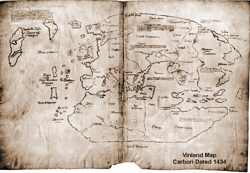
|
| The Vinland Map |
We will use the Vinland Map as an example.
This map came out in 1957 and was touted originally as a history making discovery. but in further examination, although the vellum was correctly dated and wormholes matched those of a known fifteenth century journal, an analysis of the ink revealed it had elements that dated that substance to no earlier than 1920. Many proclaimed this map as a fake.
This would generally give the consensus to the nay sayers except, and I quote Owen, "Who is to say that the ink on the original map wasn't so worn, such as that of the Resen Map, that somebody didn't trace over it in the modern times? (1930-1950)". Disprove it.
Now here is my two bits worth. Firstly, if one looks at the map one can see certain areas appear to be bolder than others. Some lines are faded, others sharp, as if they were retraced. Secondly, recently I was talking to a young gentleman of Scandinavian origin. He stated his family had some property documents that dated back to the fourteenth century. Interestingly, they decided to have these documents forensically analysed. He said that the paper was dated back to the proper time but the ink was not, having traces of modern elements in it. He was positive these documents were as old as they were, having been in the family for generations. Now although this can only be chalked up as heresay, it does bring up the feasibility that there are other documents of similar ilk. Perhaps determining the presence of modern ink elements on known, genuine documents will place the Vinland map in an entirely different light.
I think there is more yet to come on this subject.
July 1, 2017
Canada 150
I have recently read the reports of the Archaeologist Patricia Sutherland. They are posted on the Canadian Museum of History website; entitled DORSET-NORSE INTERACTIONS IN THE CANADIAN EASTERN ARCTIC
My first comment is Bravo!!
To Patricia for the diligence of her work and to the Museum of History for their integrity in publishing her report intact. Now we as the general populace can see the cold hard facts (pardon my pun).
Not only does she examine numerous artifacts from the post millenium Norse era but also concludes, based on carbon dating of three particular items that it is very likely the Dorset had contact with a European people hundreds of years before the Norse of the sagas!
The Albans of ancient legend now appear to entirely change our perspective of pre-Columbian North America. Perhaps Farley's Farfarers is not as far fetched as we few fine fellows figured. History is changing my friends.
August 10, 2017
I ran across an excellent article by an Ottawa journalist that was released as part of the opening of the Viking exhibition in Ottawa dated December 2015. In Part One of his article, Lost Viking Settlements in Canada Andrew King examines the exhibit in relation to the Vinland Sagas and then proceeds in the second part to look at some of the Norse or purported Norse evidence that has turned up through the ages. He examines the Yarmouth Stone (1812), Sodus Bay spearhead (1929), Beardmore sword and axe (1931); the same that Mallery referred to as being from Nipigon, a sword from Labrador (1953), the Maine Penny (1957), the Rainy Lake mounds (1957) and the finds in Prince Edward County of 1860.
Andrew then pinpoints these locations on a map and associates them into potential waterway routes along the east coast to Maine, up the St. Lawrence to the Great Lakes and through Hudson Bay/Lake Manitoba to the interior. A quite fascinating and realistic supposition. Interestingly, the Kensington Runestone is not mentioned at all yet would fit nicely into this map geographically. Anyone interested in this article can access it here:
I think it is very feasible that a people reknowned for their exploration skills would explore.
October 5, 2017
It is time to re-examine some of these telltale signs of Norse exploration. Let's also look at potential colonization. The big question is, how far did they possibly go?
If we accept that Andrew King's theories about their visits to the interior and east coast of North America are feasible, by comparing the known artifacts or sites along the way AND by examining the tales and legends of the indigenous peoples, we can perhaps paint a more clear picture of the Viking incursions that may or may not have actually occurred.
Let us consider the major routes into the interior first. I am going to run from west to east. We can then look at coastal possibilities.
We have the suggestion that the Norse explored into Hudson Bay. With Patricia Sutherland's documented Dorset interactions this is quite feasible. At this point in time however no hard evidence has turned up although there are groups searching the area, some for years.
In Farley Mowat's book Lost In The Barrens the two heros of the story unearth a Viking grave in the north of Manitoba where the tundra begins. This was entirely a piece of entertainment. If I recall, I believe the helmet had horns on it. Although unlikely, it does bring up the suggestion: did the Norse explore or settle into the tundra or the north? My guess would be probably not considering they already had plenty of that. Additionally, they were a seafaring people and would have been more interested in exploring the waterways. There were plenty of those to follow. I do not believe they would have penetrated much further west than the Winnipeg/Red River system, if even that. If anybody has anything to the contrary, I would be happy to hear about it. I am eager to be proven wrong on this matter.
The Churchill river system empties into Hudson Bay and this would have possibly been one of the routes to the interior. South into Lake Winnipeg and the Red or Winnipeg River systems. Even into the not so distant past this has been a traditional trade and immigration route. It has been the main highway of the Hudson Bay Company since 1670. Many waves of settlers have also made their new homes in the west through this route. These pioneers range from such diversified groups as the Selkirk Scottish to nineteenth century Icelanders.
Flowing into Lake Winnipeg is the Red River, a direct route south all the way to Wahpeton (North Dakota). The Red River then terminates and splits into the Otter Tail (east) and the Bois De Sioux (south) Rivers. This path also allows access to the Missouri and Mississippi Rivers.
October 19, 2017
The Mandan xx
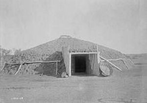
|
| A Mandan Lodge |
The Mandan are originally described to La Verendrye as being similar to the French and claiming they have European origins. Although La Verendreye does not actually confirm this upon meeting them, his detailed description of their fortifications and town system does deem them peculiarily similar to that of his own society.
On the people themselves, he reports: "This nation is mixed white and black. The women are fairly good looking, especially the white, many with blond and fair hair........the men are stout and tall, generally very active, fairly good looking, with a good physiognomy. The women have not the Indian physiognomy."
We will come back to La Verendrye later. Let's look closer at the Mandan.
According to Charles W. Moore in his 1998 article DID 14TH CENTURY SCANDINAVIAN EXPLORERS VISIT MIDWESTERN NORTH AMERICA?, it is reported in The Pennsylvania Packet and Daily Advertiser that 'a new nation of white people' had been discovered in the west. This report was dated 1784. Additionally, Thomas Jefferson was said to have believed that the Mandan were descendants of the Welsh Price Madoc and his followers who came to North America in 1170. These thoughts were so prominent that in 1796 a Welsh explorer by the name of John Evans set out to visit the Mandan to find if this was factual. He reported in the negative. The Mandan and their language were not related to the Welsh.
The next major encounter with the Mandan is in 1804 by the Lewis and Clarke expedition. It is reported that one of their chiefs, Sheheke, nicknamed 'Big White Man' because of his features, was taken east by Lewis and Clark to meet Jefferson. A full report can be viewed here:
Prince Maximilian of Weid and artist Karl Bodmer stayed with the Mandan in 1833/34. They also mentioned the fair features of the Mandan.
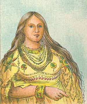
|
| Blue Eyes and Blonde Hair? |
Or can we?
The smoking gun of those who believe in Mandan-Viking contact use one of these portraits as their evidence. It is of a woman who has blue eyes and blonde hair.
I wanted to verify this picture but after having searched through hundreds of Catlin's paintings on the Smithsonian website, I was not successful in finding any 'blond haired blue eyed' natives. I did notice a few of the Mandan that showed what you might call Nordic features. As a matter of fact, two paintings; String A Reknowned Warrior and Mountain Of Rocks both display men with facial hair, one a full beard. Another painting, Mink A Beautiful Girl shows a woman with very fair skin and European appearance.
So where did this blond haired, blue eyed lady come from? After much searching I found out that Catlin published a book in London in 1841 entitled Manners, Customs and Condition of the North American Indians. In it were hand painted lithographs, one of which featured our mysterious lady. She is part of a panel of four portraits. All four display blue eyes. Our subject in question is named 'Mink' and is the same person that is mentioned in the above painting. However, in the actual, earlier painting, Mink's eyes are burnt umber (dark brown) and her hair is black. Another lithograph of Mink can be seen in the Paul Dyck collection at the Buffalo Bill Center of the West in Cody, Wyoming. Here she also displays black hair and burnt umber eyes. In all three examples the pattern of her dress and beaded bracelet are exact. One can however notice quite a color fluctuation from two of the artworks to the lithograph in question.
|
| Painting of Mink, 1832 |
According to Catlin however in his book North American Indians (Penguin reprint 1989 pp87-97) he had this to say about the Mandan:" I have been struck with the peculiar ease and elegance of these people, together with the diversity of complexions, the various colors of their hair and eyes, the singularity of their language, and their peculiar and unaccountable customs.....there are a great many of these people whose complexions appear as light as half breeds, and amongst the women particularly there are many whose skins are almost white, with the most pleasing symettry and proportion of features, with hazel, with grey and with blue eyes."
Some would say the blonde hair and the blue eyes of the Mandans is a genetic mutation. That is a distinct possibility. My daughter-in-law has a friend that is Mic-mac in Nova Scotia. I viewed a picture of her and her brother who was born with blonde hair and blue eyes. Perhaps there is some partial form of Albinoism involved here?
There are also proponents of a different theory, that of a race of Caucasians from the Canary Islands called the Guanches that emigrated to North America thousands of years ago and established tribes throughout the continent.
Nevertheless, if in fact the Norse did assimilate into the Mandan, who is to say they had the dominant genes? As well, over hundred of years, simply based on number, these genes would be very well dissipated.
Although there is nothing conclusive at present on whether the Mandan and Norse intermingled, it is an indicator of that possibility. Some simple DNA testing should put this matter to rest although that may not be as easy to accomplish as one might think. The Mandan were decimated by smallpox in 1837-38 and it would be neccesary to find a documented modern day survivor willing to provide a sample. Optionally, with permission of elders, bone testing would work.
Here are a couple interesting articles on the Mandan mandate. The first is by Neva Bodin, published in Wranglers in 2014:Blond Blue Eyed Indians
Charles W. Moore's article from 1998 entitled DID 14TH CENTURY SCANDINAVIAN EXPLORERS VISIT MIDWESTERN NORTH AMERICA? delves into this theory a little bit deeper and touches upon the Kensington Runestone. He maintains that a Norse expedition commissioned in 1354 came to grief in the west and ended up with the Mandans. Moore is not alone in this line of thought. Several other scholars are of like mind including Hjalmar Holand, a principal in the early days of the KRS (Kensington Runestone). We will look at this enigma later on our cross country journey.
Although I was unable to verify some of Moore's suggestions in specific regards to the Mandan what I could find was relatively accurate and brings up some distinct new possibilities to look at later. Of particular interest was their own origin myth. One of their legends tells of a great flood and a forty day rain. Another legend has a distict flavor of evolution.
Mother Frog speaking to the creators, "....we must make death so that the first ones may pass away and new ones come."
In closing with the Mandan, there is reports of a bone found with Norse runes on it at one of the Mandan sites. At this time I have no further information on this.
November 15, 2017
Technology
In the true course of history there is no such thing as a cut and dried straight path. It is more a severely winding road with directions that are constantly changing, new branches perpetually appearing and if the branches are retraced backwards, alter as critical signposts must be relocated. What I was taught was history as a child, is now something completely different.
But then, the world is different. We have so much more to go by as we are searching for our past. Today we have the great help of technology. This has come upon us like a hurricane. DNA testing. Carbon dating. Spectrographic analysis. Comparison technology. Satellite imaging. Ground penetrating radar. Scanning electron microscopic analysis. Forensics. Experimental archaeology. Sonar imaging. All this tied together by the internet. What once took years to determine or research can now be done in minutes with a google search.
So rather than wait for the evidence to present itself, the modern scholar will instead look at a situation analytically, place his hypothesis and then actively seek the evidence. The modern scholar can be likened to the treasure hunter of past decades. Mind you, the modern living history re-enactor would have, forty years ago, been likened to the proverbival Napoleon and relegated to his own special little Elba!
As history builds upon itself locations of proof are pointed out to us and we can progress to reveal what actually happened. With that revelation comes more evidence that allows us to step forward and repeat the cycle. We cannot overlook past finds however. Many items, relegated to a backburner, dismissed as a hoax or thought to be so inconceivable they are ignored, can be relocated and reexamined with our modern analytical tools. They can become the critical signposts that we mentioned above.
This is currently what is happening with the pre-Columbian European history of North America, or should I say 'Norse' America. With all the tools we have at hand we find a much more astounding and unexpected panorama that completely alters the views of the standard history that we were taught. Originally, Sagas created rumors that encouraged us to seek a single Norse location in North America. Several areas were examined and finally a site was found. That location gave proof that the Norse were elsewhere and by getting put into the proper perspective of the picture, this then led us to additional sites, many already well known. From those additional sites we learn of links to other possibilities. That now opens up a whole new line of concept. In the past these indicators were many times poo-pooed or shunned by obtuse people who could not conceive of the extent of the probabilities and thus relegated many important finds to dormancy. Unfortunately they themselves now make their way into obscurity or far worse, mockery as our knowledge increases with the advent of superior evidence. Our friend Technology certainly has a habit of squashing those who believe the world is still flat and it will effortlessly leave them behind in the dust.
Speaking of technology, an interesting application of that factor is genetic tracing. By analyzing people's DNA in any particular area, one can see distinct patterns revealing a particular group. Quite fascinating to see how populaces of certain areas can indicate colonization routes. A Minnesota friend of mine showed me a map from Ancestry.com that displayed distinct Scandinavian traceroutes down the Red River system and the Minnesota area. He is of the opinion that these tracings are much older than we imagine and indicate possible pre-Columbian settlement. I have encouraged him to do some Viking hunting.
While looking at these genetic tracing patterns and how they relate to our pioneer emigration routes it made me ponder about other traditional migration routes. The caribou in Vinland would go to the Long Range Mountains in the spring and return to the interior lakes in the fall as an example. Birds fly north and south. It is quite clear that animals have these routes but what about humans? Could we have some sort of migration pattern inbuilt into us as well? Some genetic director to tell us where we must go when we seek new homelands.
If we had distant ancestors that travelled to a certain place would we then have an urge to follow in the same path? Could the Scandinavian traceroutes mentioned above be an indicator of earlier settlement? Can this be applied to other peoples? Many more questions that require many more answers. What we know today may be refuted by our descendants with the advent of their own new technologies and the gaining of additional new evidence.
December 15, 2017
Mooring Stones Part One
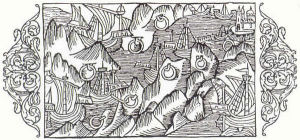
|
| Fourteenth century woodcut |
I had asked in an earlier blog to be proven wrong about any extensive Norse presence along the Red River system or west of it and I am happy to say that has been done. We begin our examination at the Whetstone River in north-eastern South Dakota at the longitude of between -97.045 and -96.519.
An item that has become a footprint of those we seek is a stone with a hand chiseled hole approximately 1 1/2 inches wide and 6 to 8 inches deep. The hole is usually in the shape of a softened triangle. These stones are known by various names but I shall call all of them Mooring Stones.
Very simply, if you consider these stones in the practical eyes of the Norse, you determine what a hole in a stone can be used for. It can be used to put things in. An iron ring can tie boats up. Not neccesarily only boats. Maybe they would also include horses. Maybe livestock. Maybe prisoners. They could also be used as tent anchors. Remember that the Norse were very utilitarian. If a wooden post was put in a hole it could display a flag or a banner. The anchored pole could be used to hold up a canopy or simply be a marker. It is possible these stones were used for all or some of the above.
Along the coast of Norway and Sweden these stones are known to have been used to moor boats in the fourteenth century. See the woodcut. Comparable stones have been found in Iceland, where Valdimar Samuelsson has been doing research on them. He determined they were also used there as property markers. As a matter of fact, the Gragas states, "If you have trouble with your neighbor over the boundary stones, you are to call your warranty man and you are to meet at the fester haell (mooring stakes). These property markers are also mentioned in the Norwegian lawbook equivalent.
These stones have also been found in Wales, Sweden and Greenland. I am sure as this field of research progresses they will be plentiful in their appearance elsewhere as well. We are only going to deal with the North American mooring stones however. Even then, to pinpoint the exact location of every one of these on the continent would literally takes hundreds of hours of effort and a huge map so I will cover many of them in general areas.
The first group we are going to look at are in the Whetstone River area of northern South Dakota as mentioned above. We are going to rely on the research of Judy Rudebusch, Bruce Kunze, Robert Johnson and Janey Westin. There are a number of other people researching and helping in this field. The participants here and at other areas are growing regularly.
Judy and Bruce have located and marked over 70 stones. They have been found at water's edge, inland, on hills and even buried deep in the earth. They have been catalogued, tested, molded and the surrounding areas scoured for other possible artifacts.
Latex rubber castings were made of some of these stones. When pulled out and examined, it was determined that the interior of the chiseling showed great age wear. One of the stones called the Settje Stone at Bullhead Lake, SD was found to contain iron rust particles. In one area a drinking horn was carved into a stone and a knife into another. This is really not surprising if we are looking for the Norse. One can imagine if they were encamped in any particular location for any length of time, they would then start doing things to the stone, as is exampled by these carved stones. At Sop's Arm, which has a large collection of mooring stones, someone did a wonderful job of what I call a seal. Page 21 of Kent Budden's book Vinland Discovery (the Unfolding Story) has an excellent picture of it.
At one of the mooring stone sites, a stone hammer and a scraper were discovered nearby. It cannot be determined whether or not these artifacts are related to the stones but it may indicate possible contact with the local inhabitants.
Our researchers will readily admit some of the stone placement may not neccesarily be accurate. It is very likely some of the stones could have been moved by early settlers in their efforts to clear the land. Holes may have been created for the purpose of blasting a stone apart with black powder by these same pioneers, perhaps also for the purpose of clearing their land or building foundations for their houses.
Mooring Stones Part Two is featured in the 2018 blog.